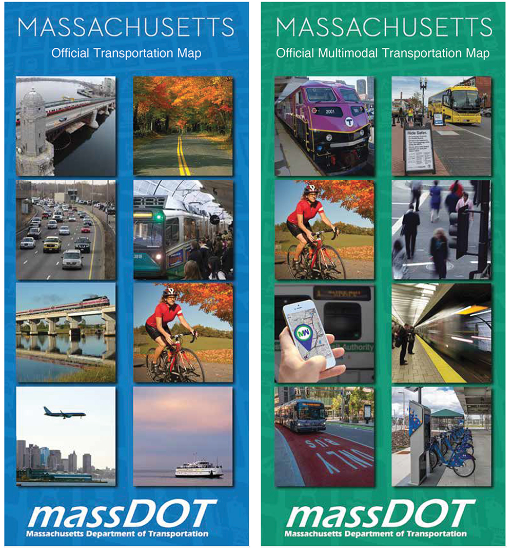
Massachusetts Multimodal Map
DATE: 2022-present
CLIENTS: Massachusetts Department of Transportation (MassDOT)
The Challenge
To create a companion to the Official State Highway Map. This map would focus on public transportation including intercity bus routes, fixed-route service by regional transit authority, and both MBTA commuter rail and rapid transit.
Development
With cultural shifts in transportation toward things like Complete Streets and more diversity and inclusion, I was approached by MassDOT about creating a companion to the Official State Highway Map.
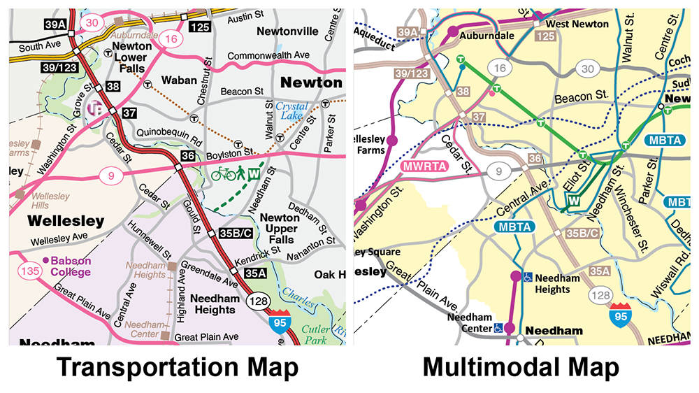
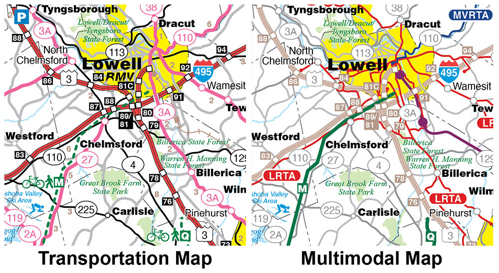
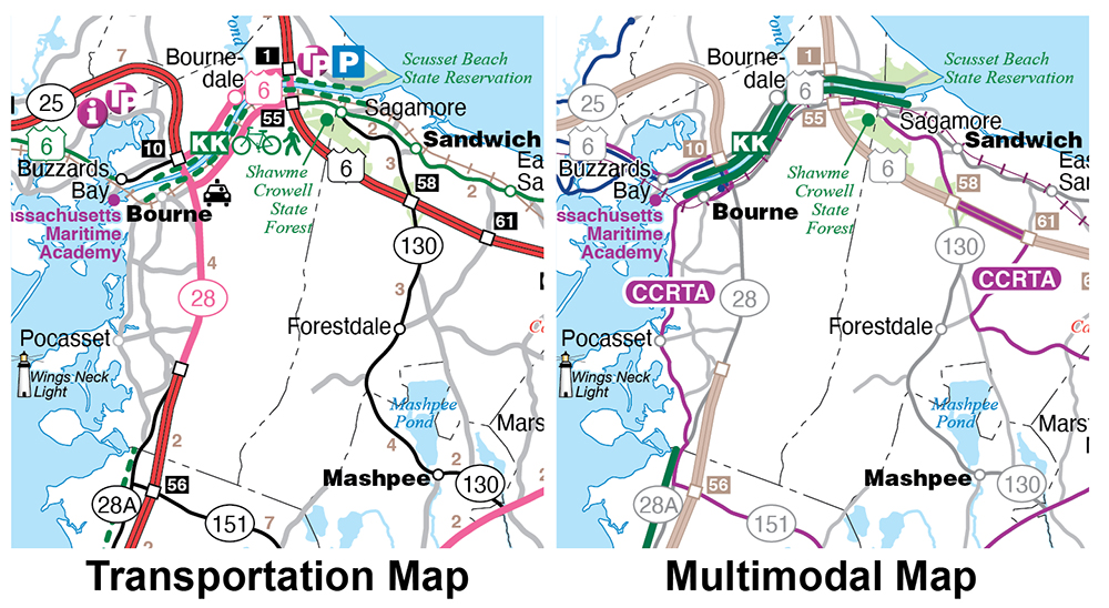
For Phase One I had to lighten or downplay all the automobile related resources, i.e., roads, highways, exit numbers, rest stops, etc.
Phase Two involved the painstaking process of adding every fixed-route bus line by Regional Transit Authority.
For Phase Three I highlighted all the MBTA Commuter Rail and Rapid Transit service.
For Phase Four I created an inset map depicting the intercity bus routes.
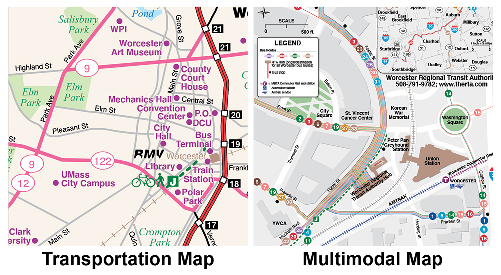
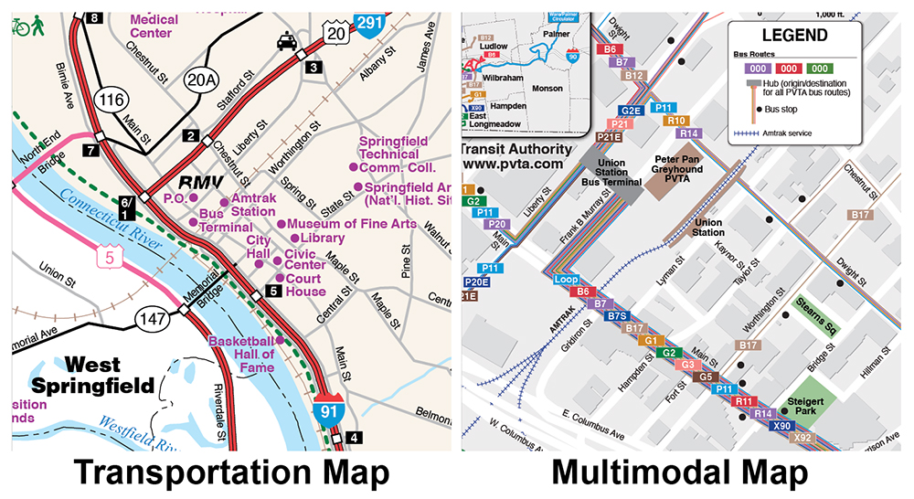
For Phase Five I reimagine the Worcester and Springfield inset boxes to emphasize public transport.
Phase Six involved creating new front covers for both the highway and multimodal map so that they appear part of a series.
Lessons Learned
Since the intercity bus routes mostly travel on major highways and make few stops, having the route lines drawn on the map would make it unnecessarily busy and confusing. I decided to put them in their own inset to not distract from the fixed-route service.
Going from roads to transit on the Worcester and Springfield inset maps was not a simple change. The whole scale had to be reconsidered. Instead of showing the highways and roads in a metropolitan area, I instead had to highlight the regional transit hubs.
On stand-alone regional transit authority maps, multiple routes on one road were depicted as parallel lines. The scale of the entire state would make this effect overwhelming. So multiple routes were depicted as a single line.
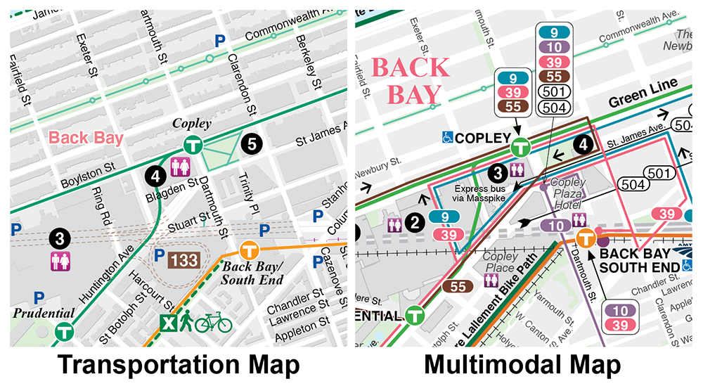
Below are side-by-side comparisons both maps