New England Transportation Map
DATE: 2012-present
CLIENT: Massachusetts Department Transportation (MassDOT)
The Challenge
To create an all-in-one public transportation map for all six New England States.
Development
This two-year project took all of my amassed knowledge and skill in order to create a digital map that was one-stop short of a full-fledged trip planner for non-auto users in New England.
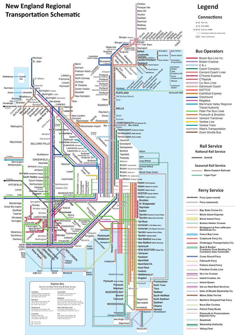
Phase One involved creating a master map of New England with all intercity bus, intercity rail and ferry services.
Phase Two involved creating individual maps for all six New England states with the public transportation options displayed.
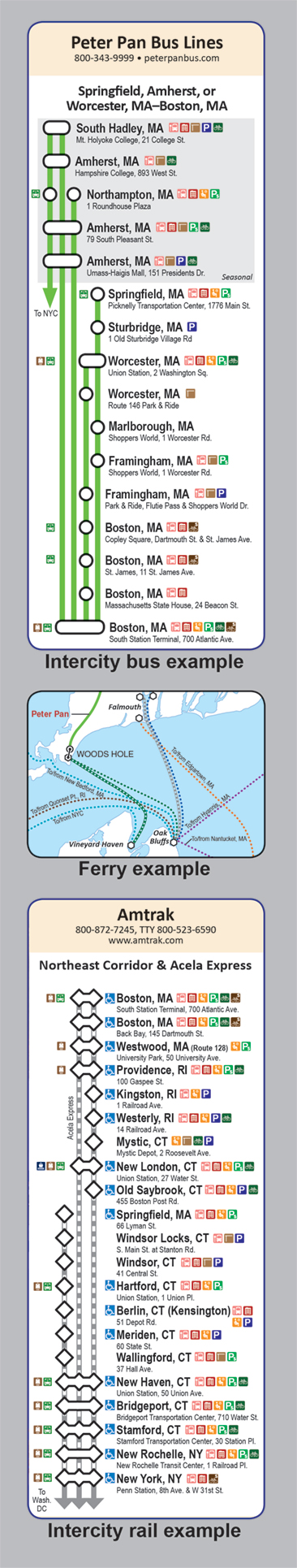
Phase Three involved creating detailed schematics (see right) all of all the public transportation services by carrier.
For Phase Four I created subsequent inset maps and used a desktop publishing program for layout.
Lessons Learned
The most difficult part of this two-year process was finding a way to display an intense amount of information in the smallest space possible. This involved the heavy use of icons. The six New England state maps originally had much more information, but over time it became clear that less is sometimes more.
The original plan was to create and print five versions of each map with the languages of English, Spanish, Portuguese, Chinese and French. Midway through the project it was announced that the maps had to have all five languages on them. This put space on the maps at a premium. Though dense in information, I believe it was a great and useful product.
NOTE: this project is in limbo. The New England map was printed and distributed, but never uploaded to any website. With the Exception of the Massachusetts Map being displayed in Boston's South Station Bus Terminal, the six New England state maps have never "seen the light of day."
There was also an accompanying schematic map that was never used. See below. It is a rare example of all transportation services being depicted as transit lines, regardless of mode.