Massachusetts Bay Transportation Authority Rapid Transit (Spider) Map
DATE: 1996-present
CLIENT: MBTA
The Challenge
To create new and better digital Rapid Transit Map.
Development
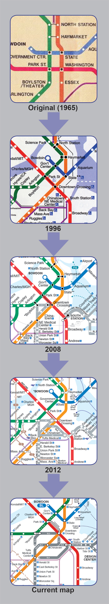
In my spare time, I had been tinkering with the MBTA Rapid Transit Map. I felt it lacked certain design elements that could contemporize it. After campaigning my new design for years, the MBTA Marketing Department began using it in 1996.
With the new design, I set out to change three major attributes. First was the Green Line. The original 1965 map omitted most of the surface stations. The few that were labeled were done so incorrectly or misleadingly. Second was to draw the transit lines closer to their actual geography. Lastly, add a shore line.
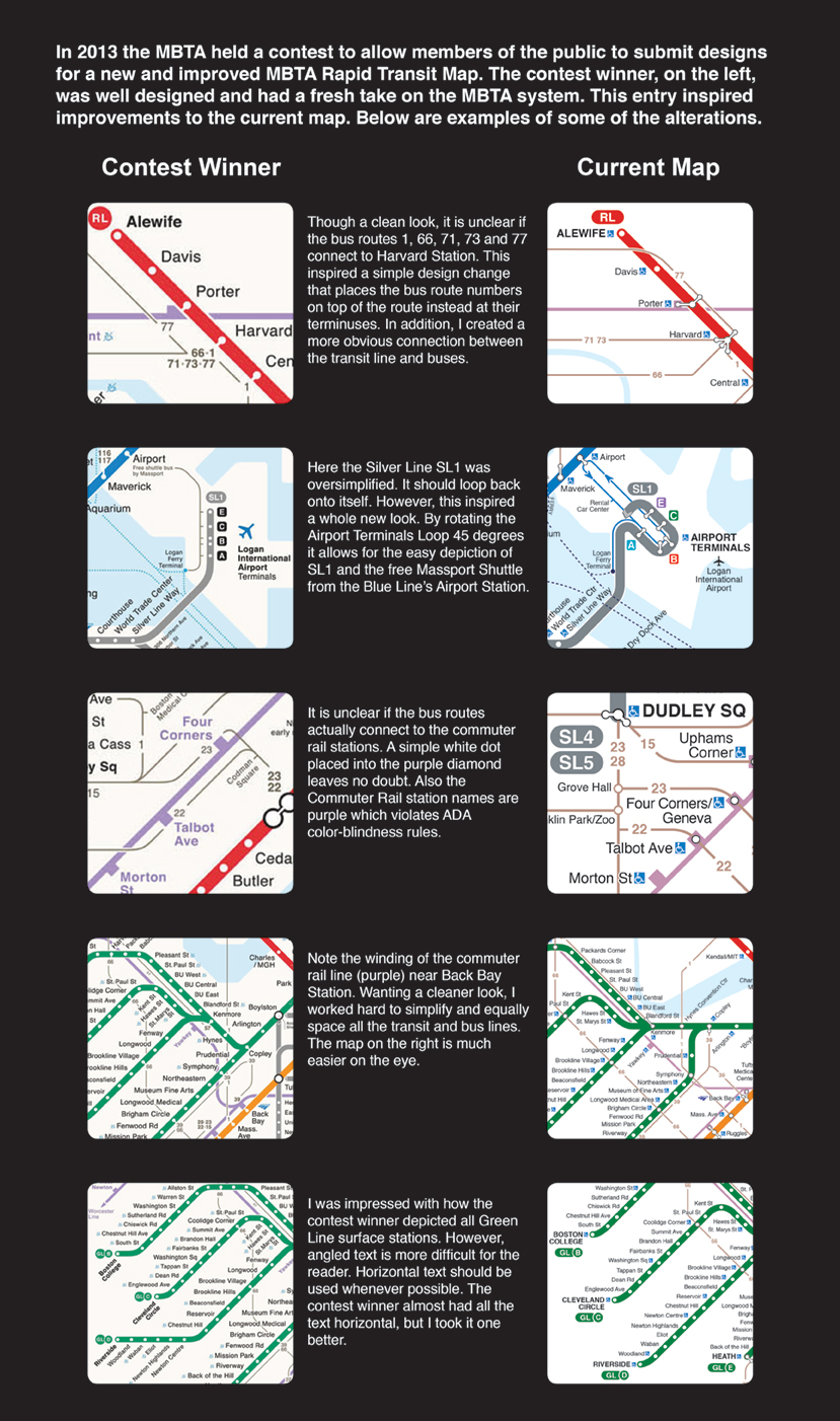
Much has changed with this map over the years. In 2002 the MBTA added a fifth transit line, the Silver Line. Fortunately my new design, with its geographically drawn transit lines, allowed the this to be easily added. Then in 2008 the MBTA instituted a Key Bus Route Program that added 15 bus routes to the map. Finally in 2013 the MBTA held a contest asking the public to submit their own designs. Based on this feedback I made many more improvements.
Lessons Learned
Over time the map has been shaped mostly by customer feedback as well as enforcement of ADA laws. Each time these challenges, though not initially embraced, have led to a better, more usable map.
The contest in the summer of 2013 allowed me to see just what the public expects from this map. Using the contest winner as a guide, much of the map was altered to meet the public expectations. See examples below.