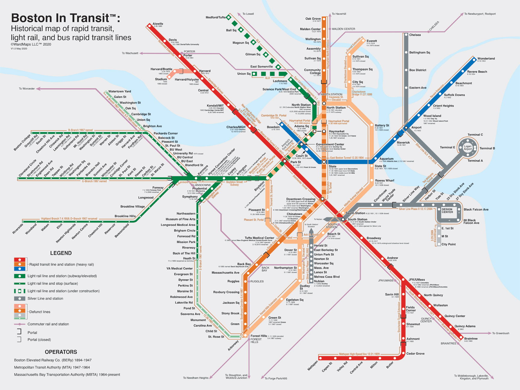
Boston In Transit™
Historical map of rapid transit,
light rail, and bus rapid transit lines
©WardMaps LLC™ 2020
Professional design-orientered cartographer creating multitudes of maps.
Boston In Transit™ Historical map of rapid transit,
|
|
 |
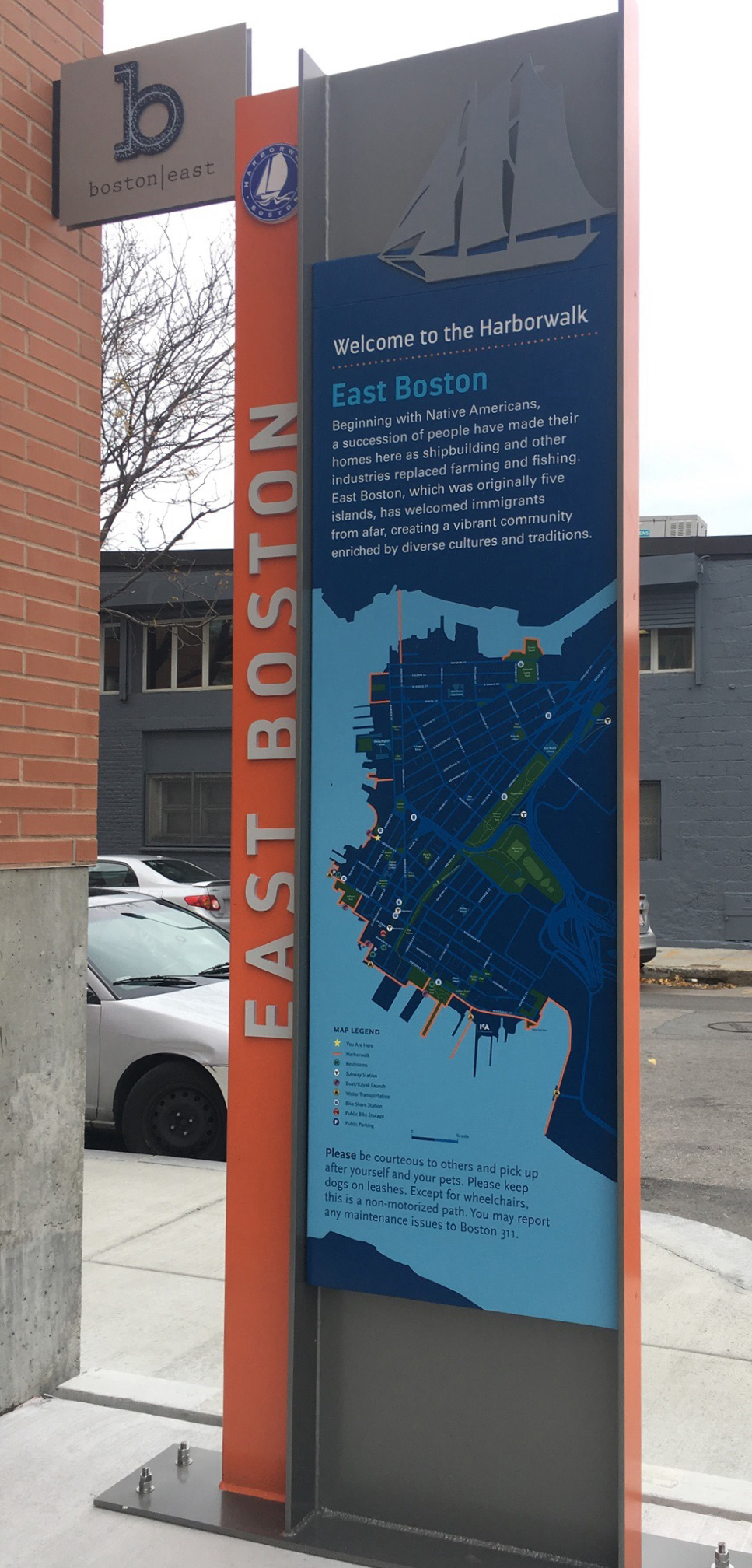 |
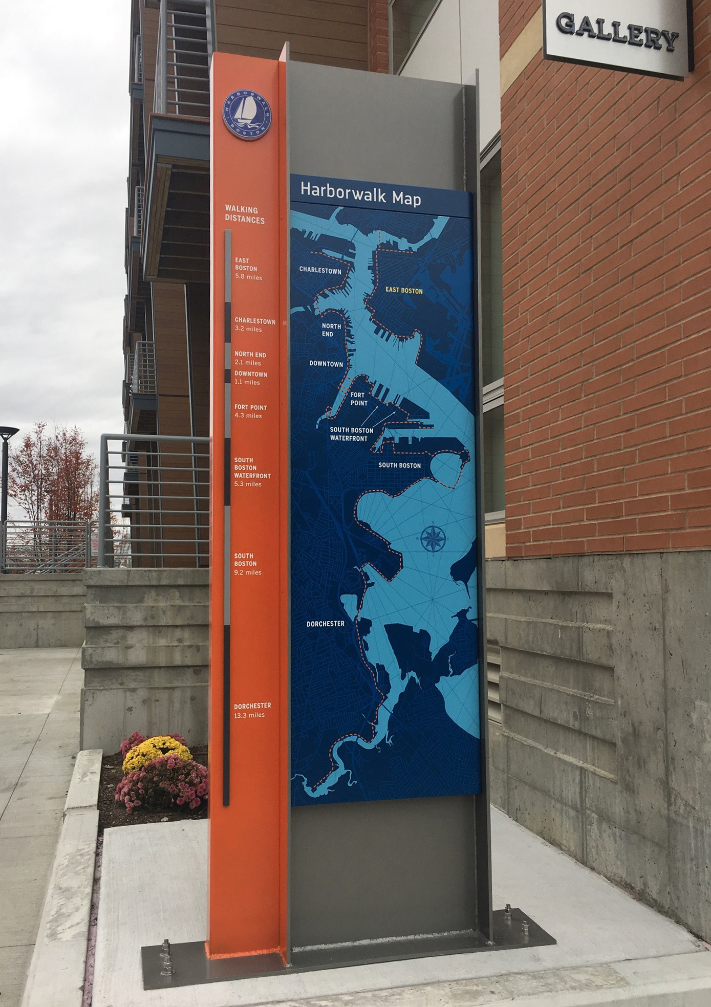
| Boston HarborWalk kiosk in East Boston side A, overall map | Boston HarborWalk kiosk in East Boston side B, local map |
 |
 |
 |
 |
|
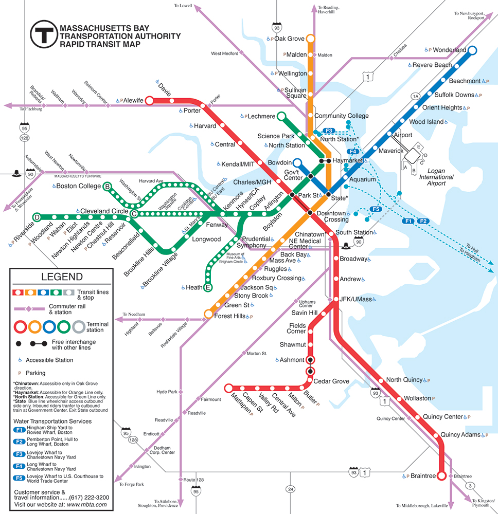
2000 Massachusetts Bay |
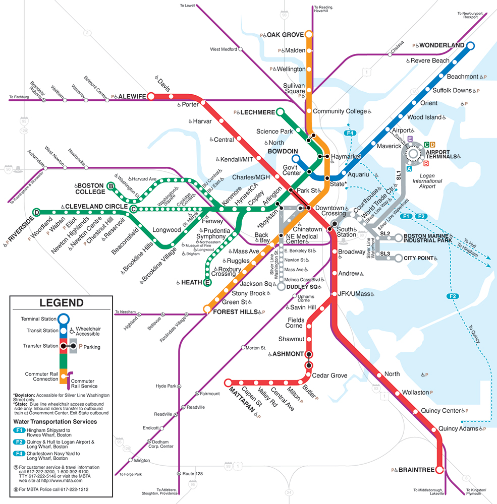
2005 Massachusetts Bay Transportation Authority Rapid Transit Map |
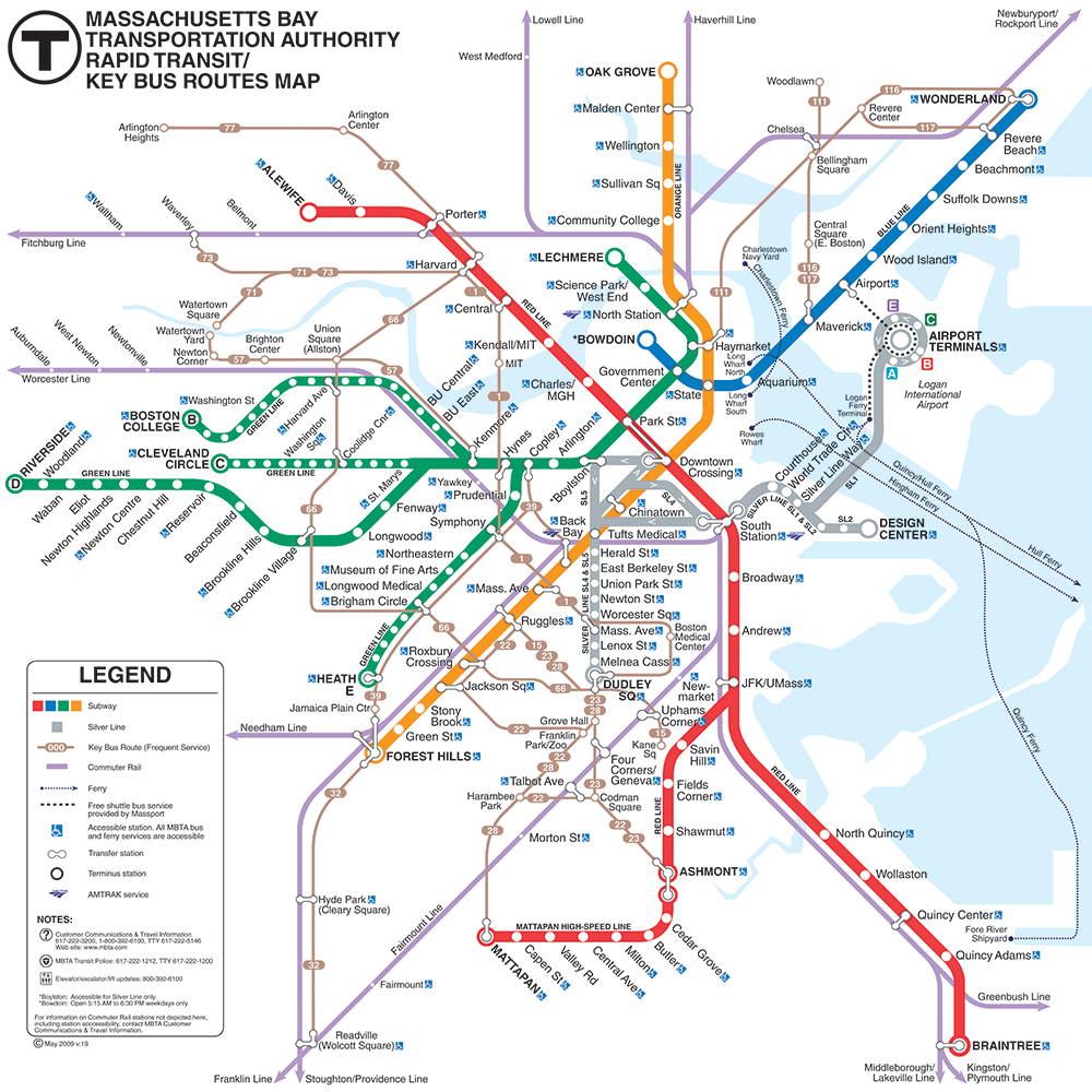
2009 Massachusetts Bay Transportation Authority Rapid Transit Map |
 |
 |
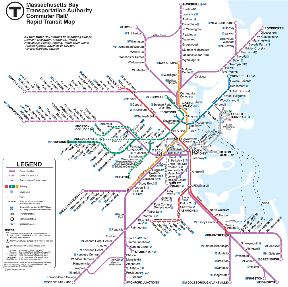
| 2009 Massachusetts Bay Transportation Authority Commuter Rail Map |
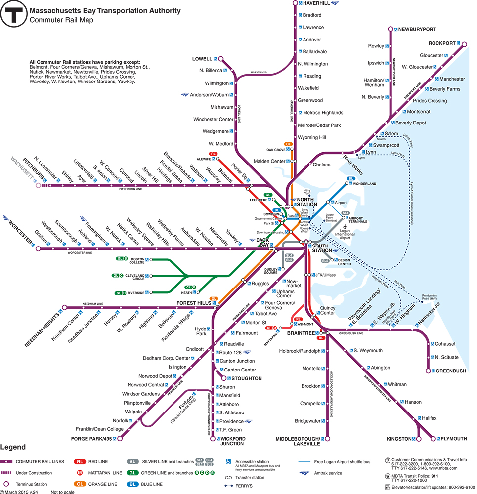
Current Massachusetts Bay Transportation Authority Commuter Rail Map |
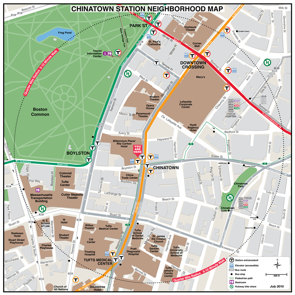
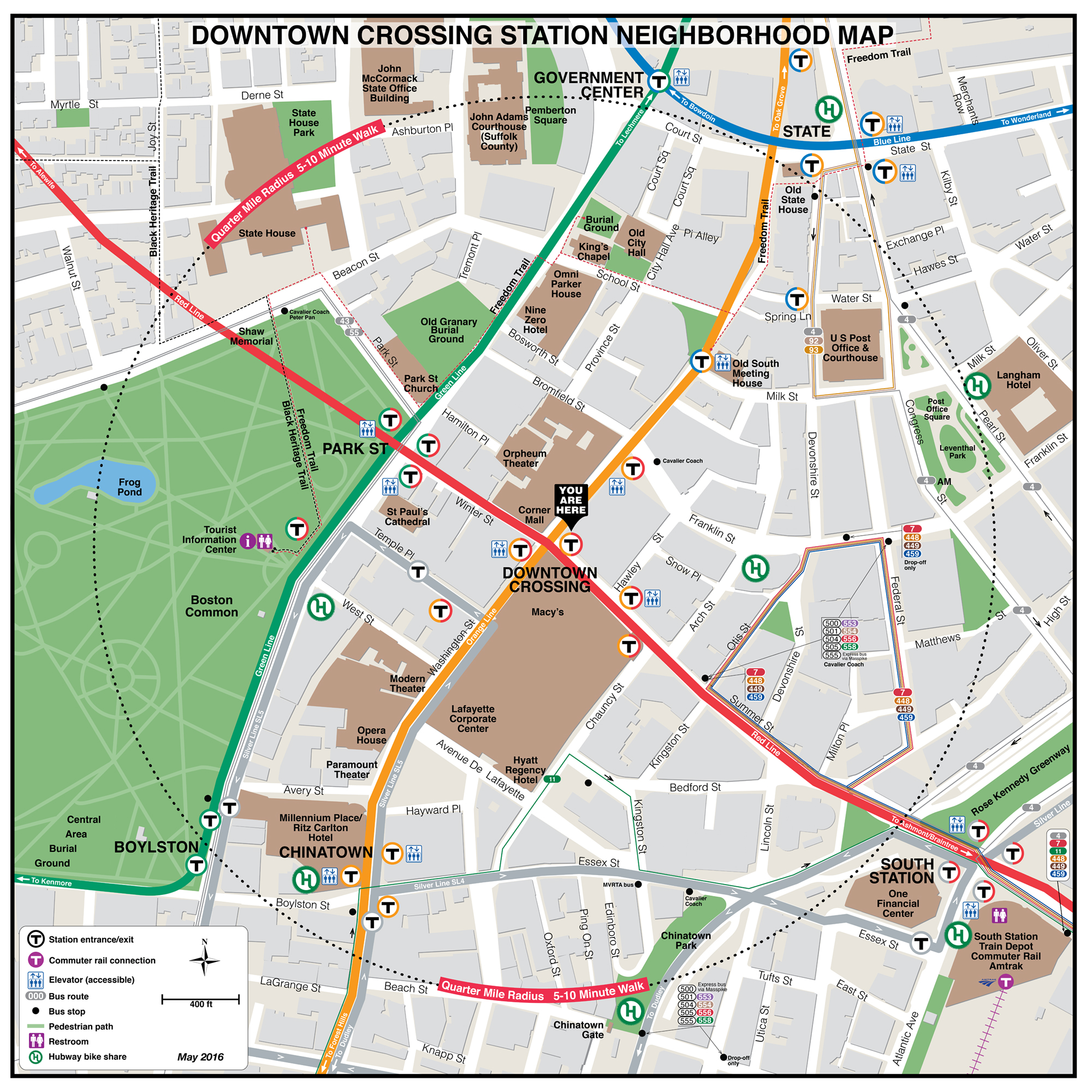
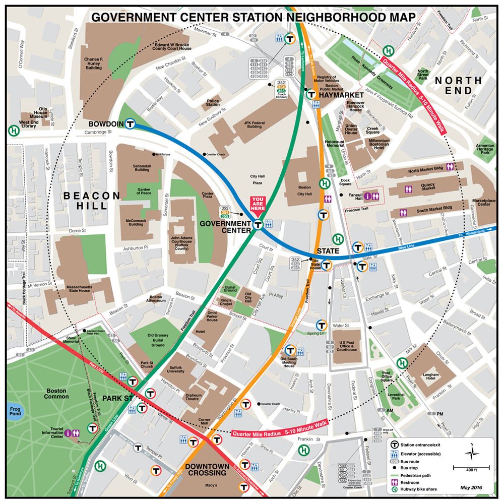
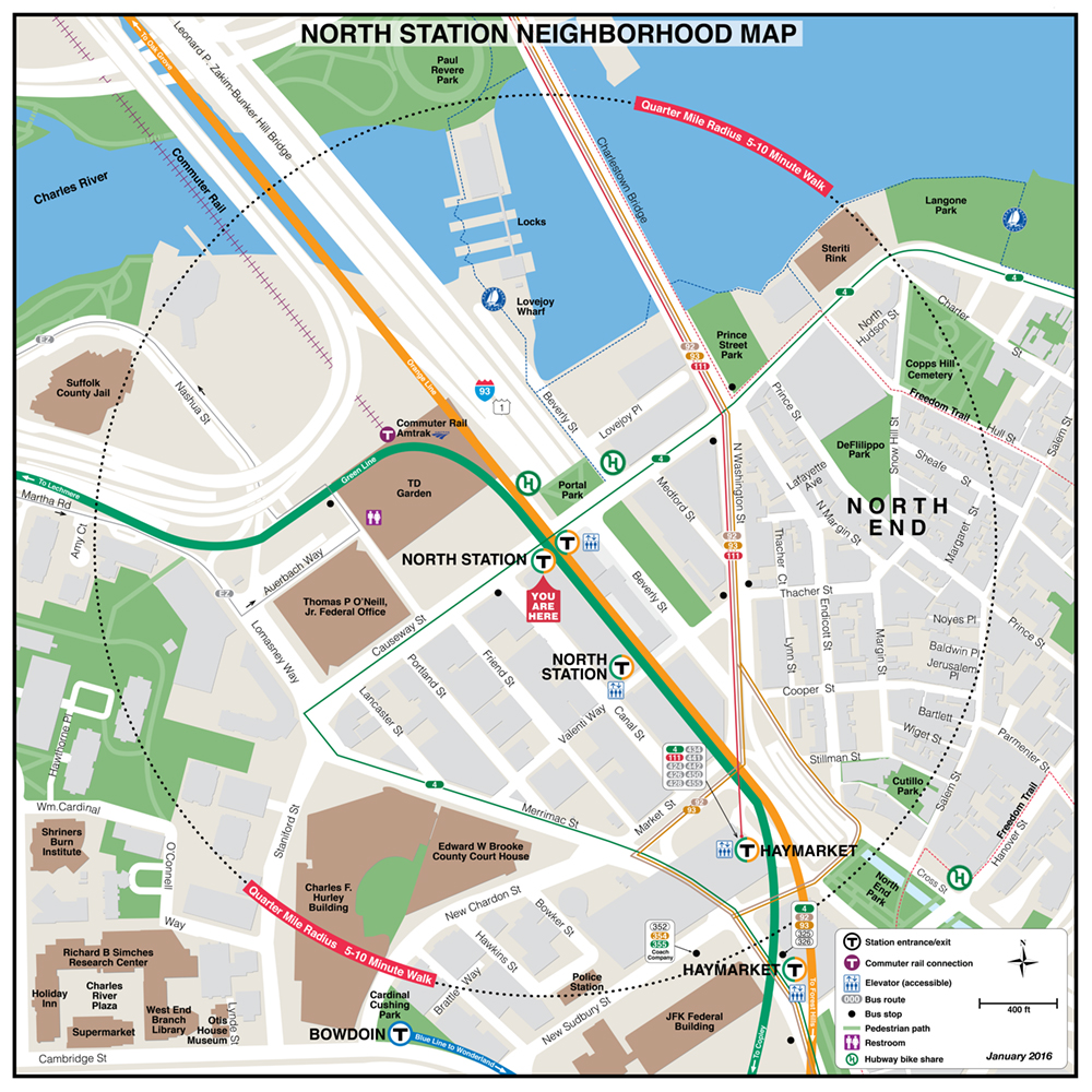
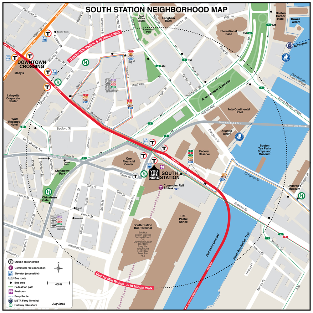
MBTA Downtown Neighborhood Maps
 |
 |
 |
 |
 |
 |
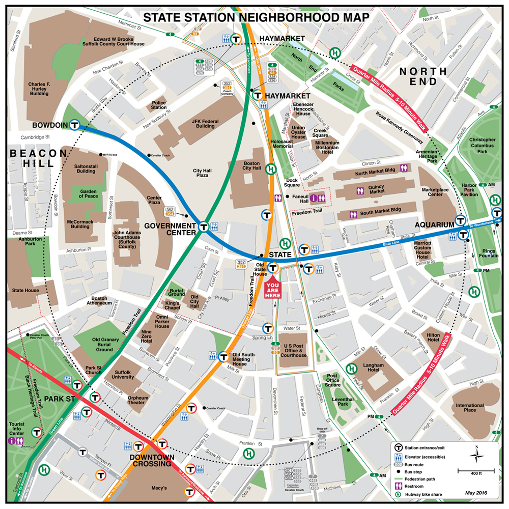 |
| Downtown Crossing | Government Center | North Station | Park Street | South Station |
MBTA Red Line Neighborhood Maps
 |
 |
 |
 |
 |
 |
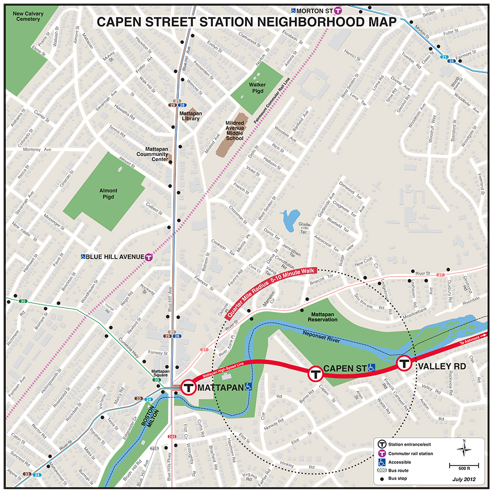 |
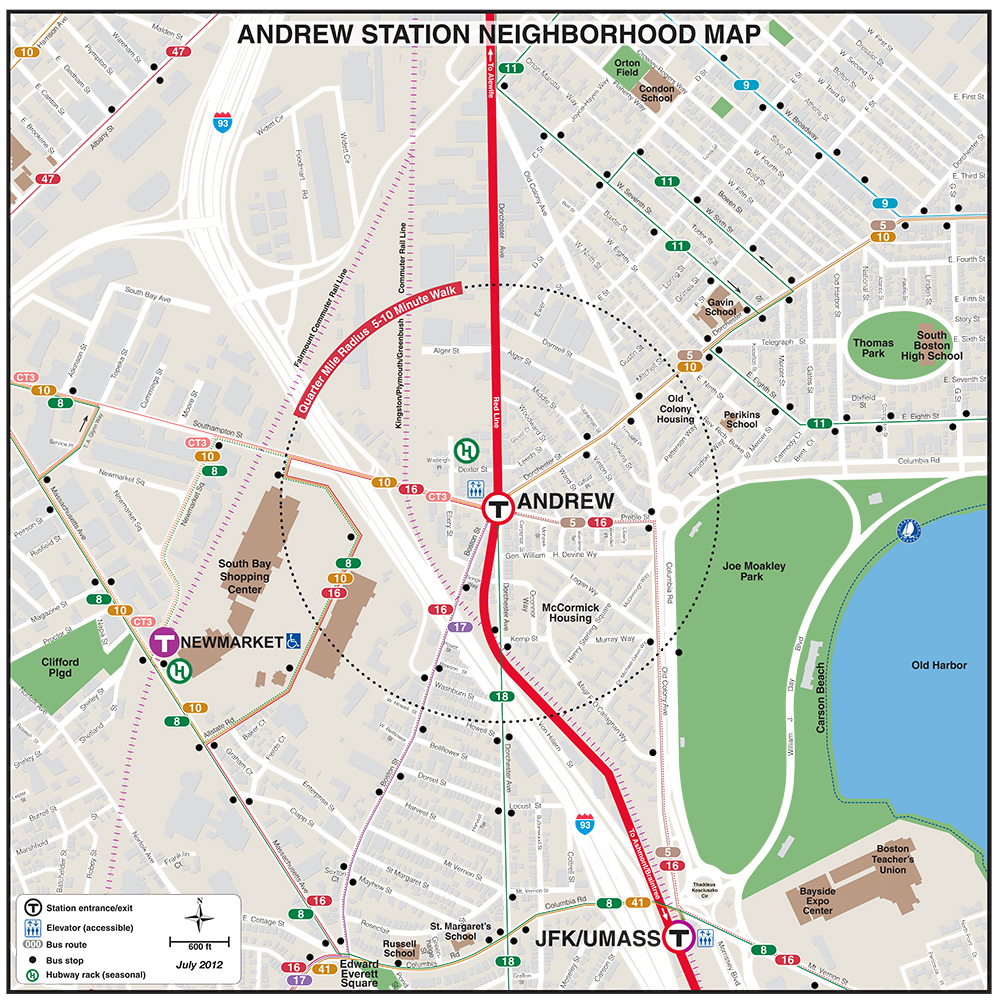
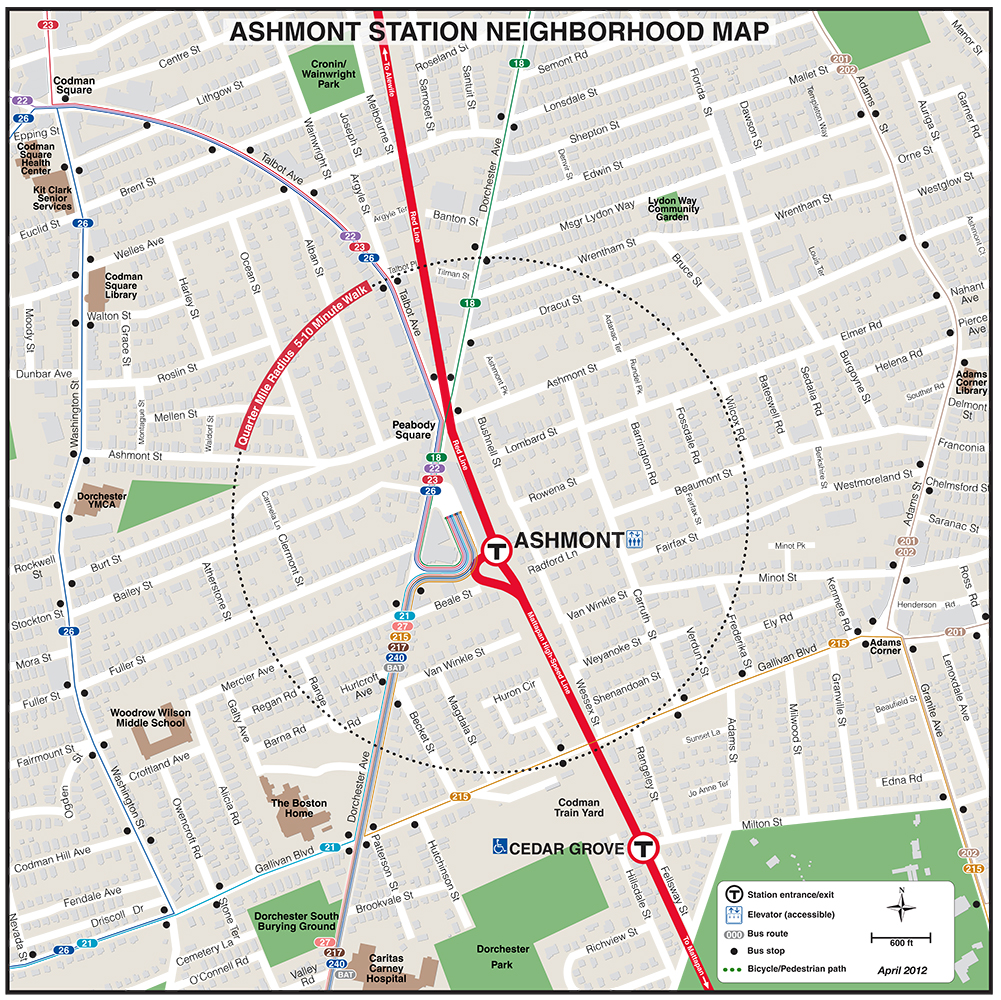
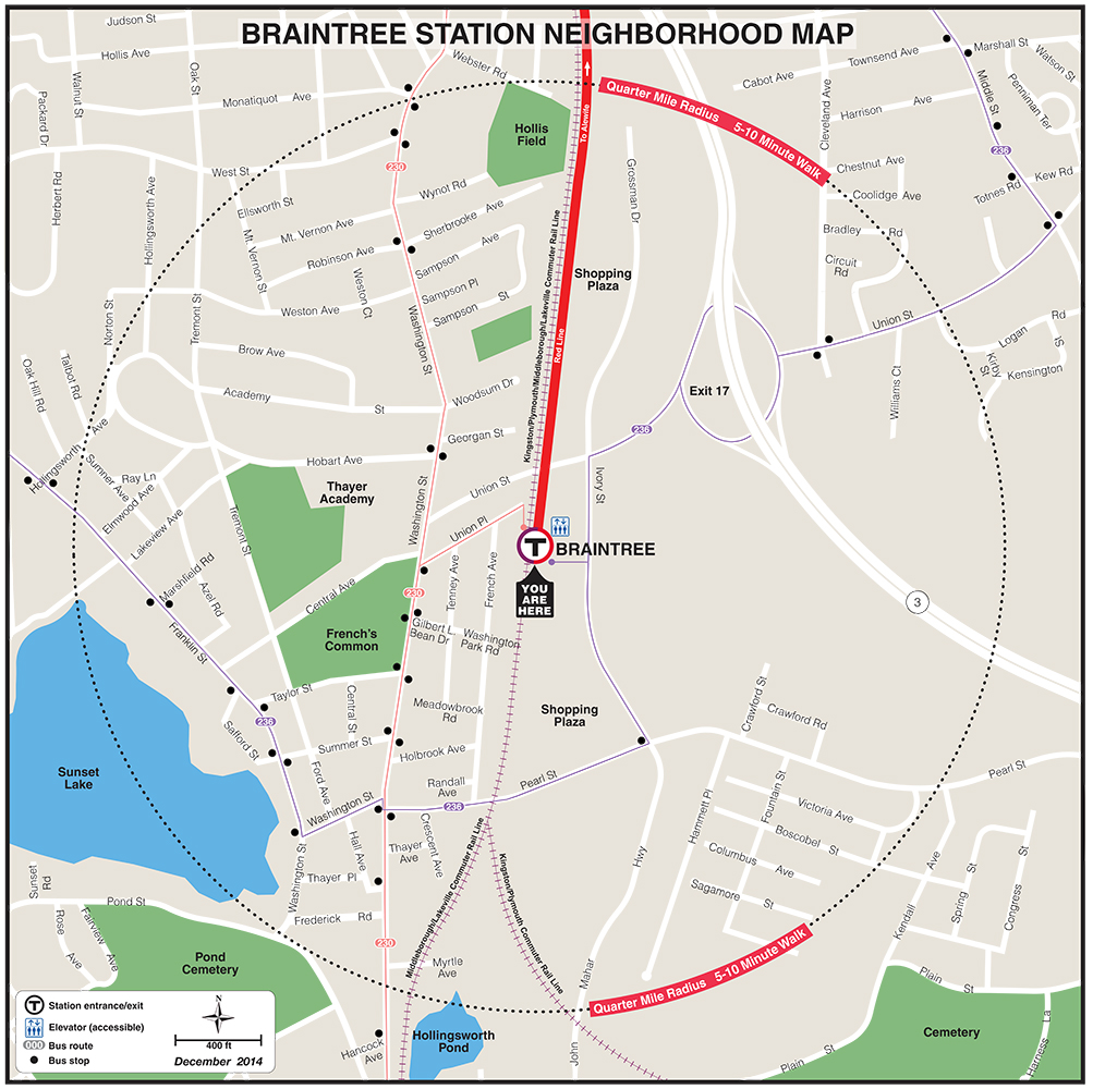
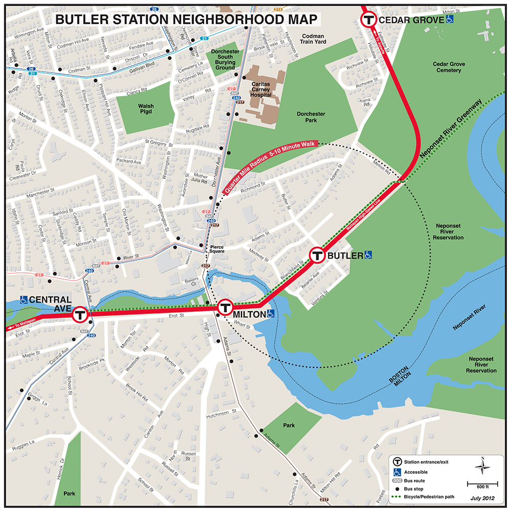
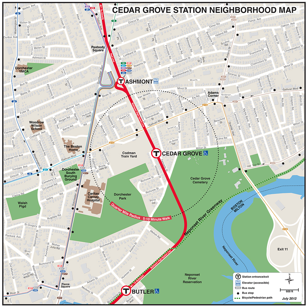
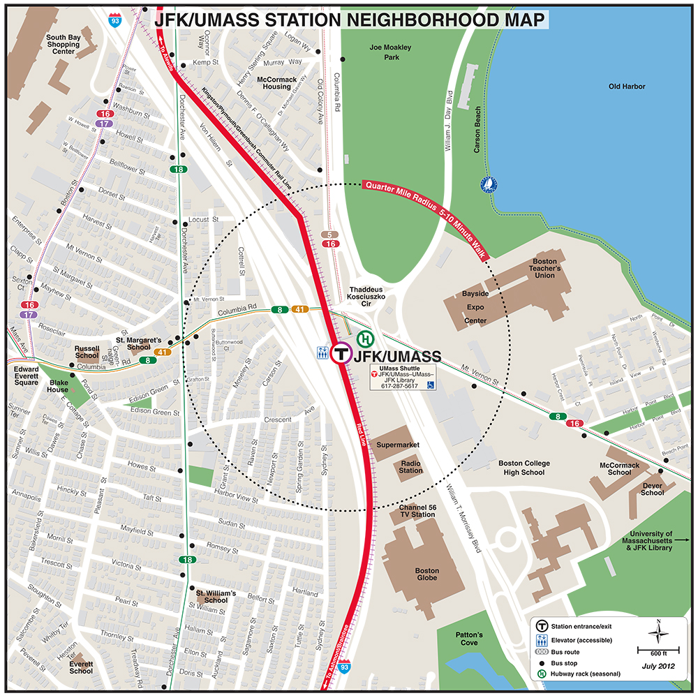
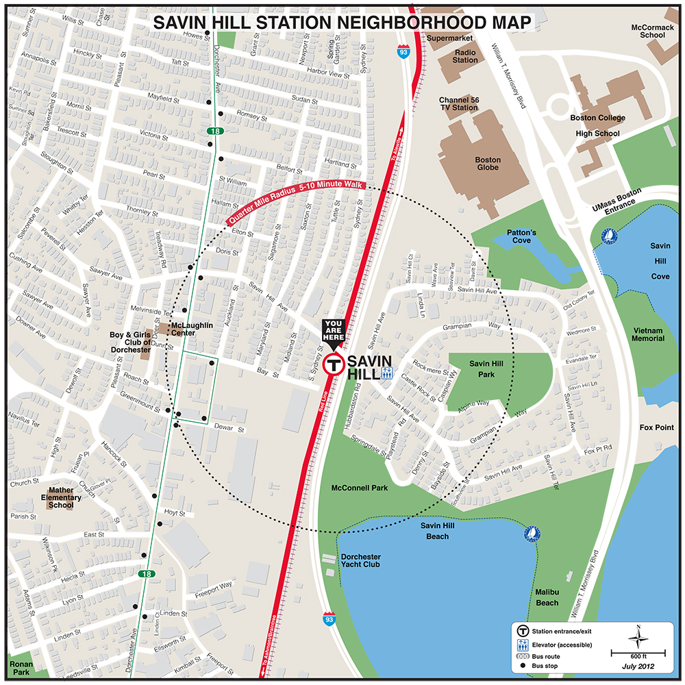
| Andrew | Ashmont | Braintree | Broadway | Butler |
 |
 |
 |
 |
 |
 |
 |
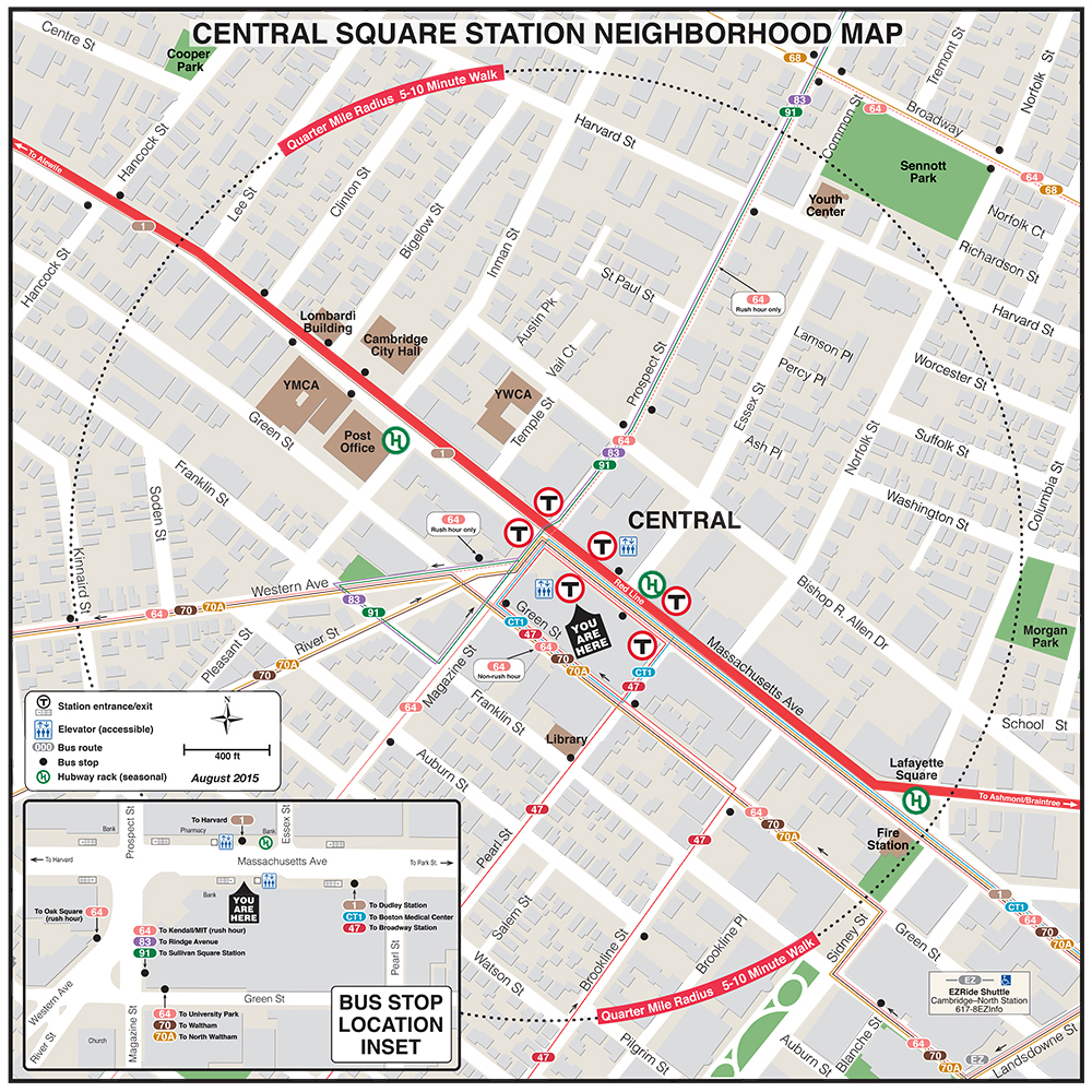
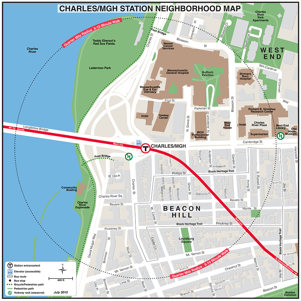
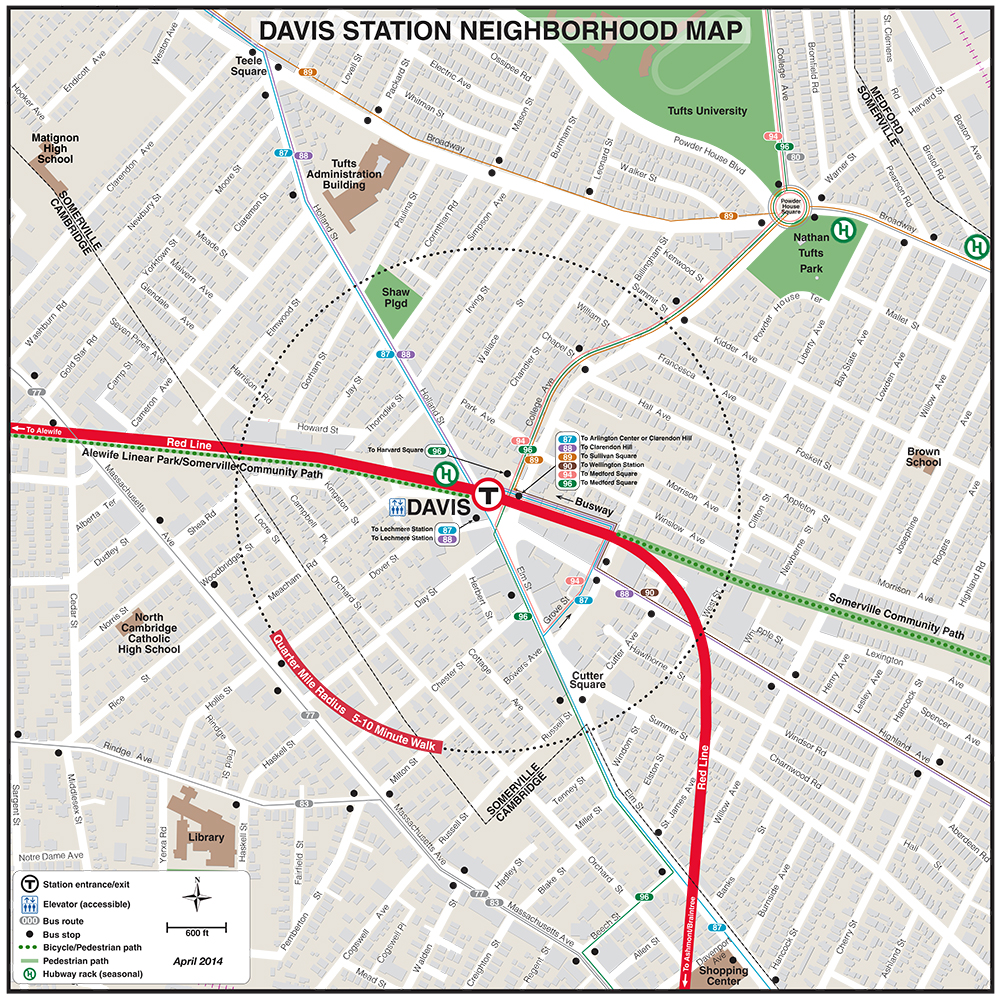
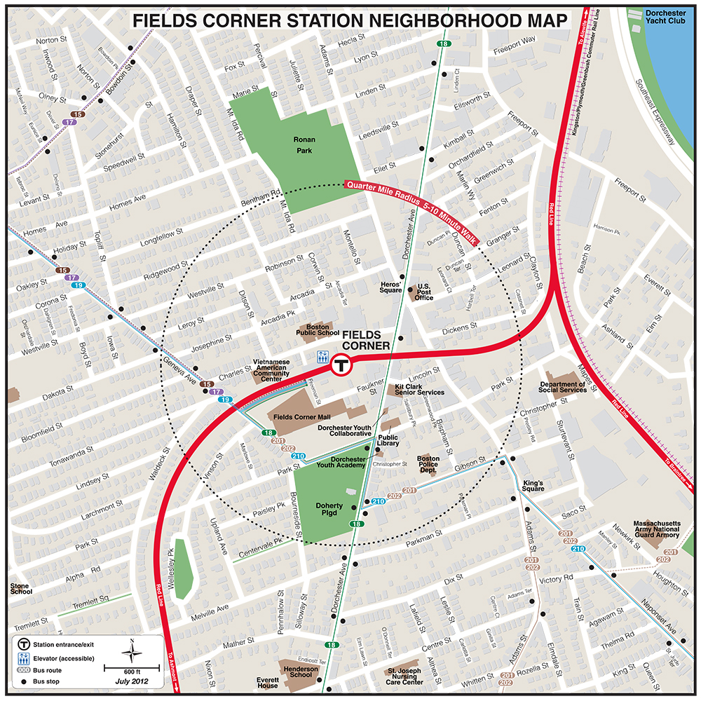
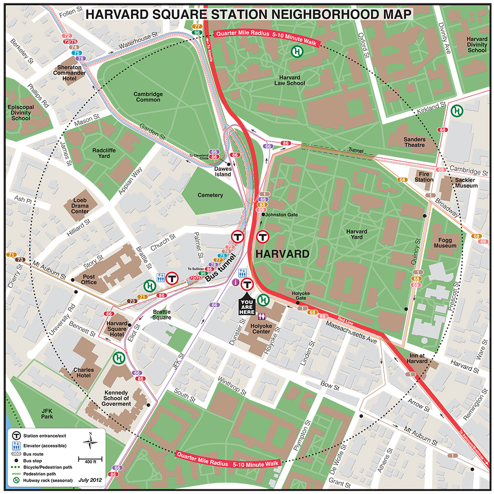
| Central | Charles/MGH | Davis | Fields Corner | Harvard |
 |
 |
 |
 |
 |
 |
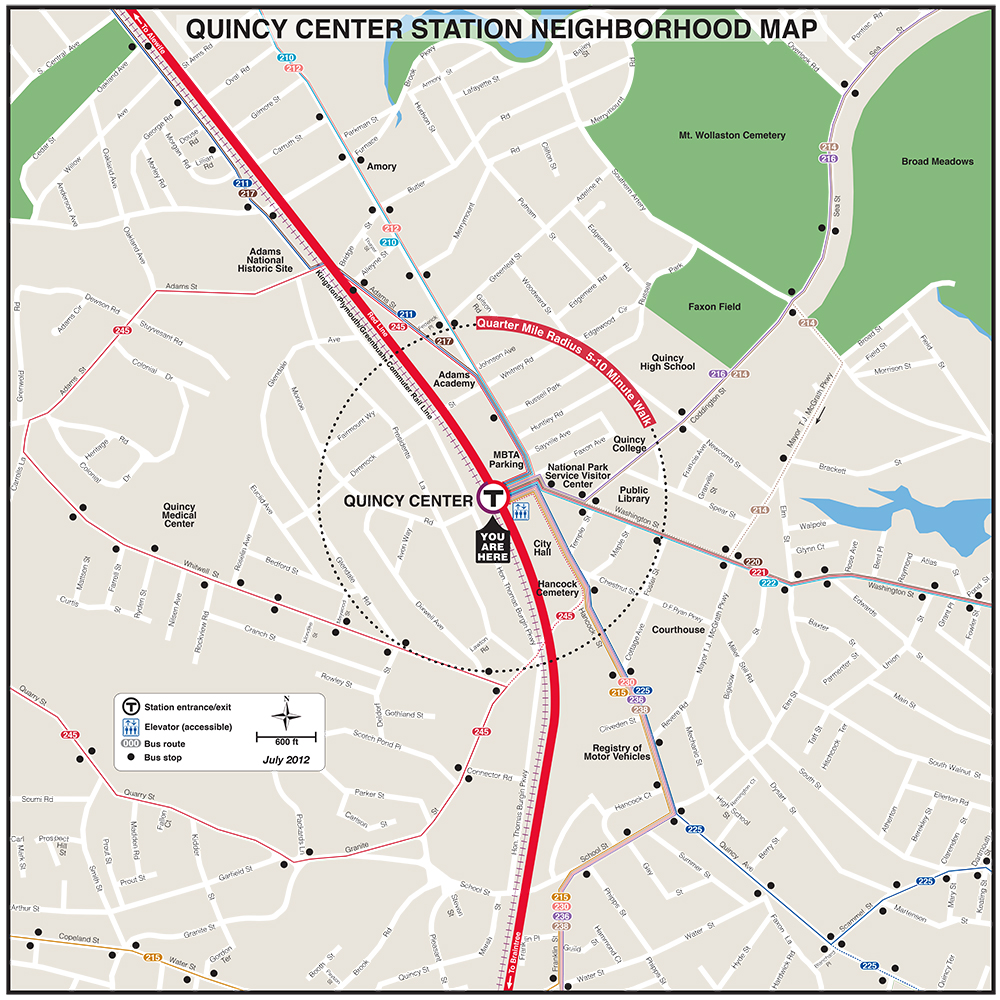 |
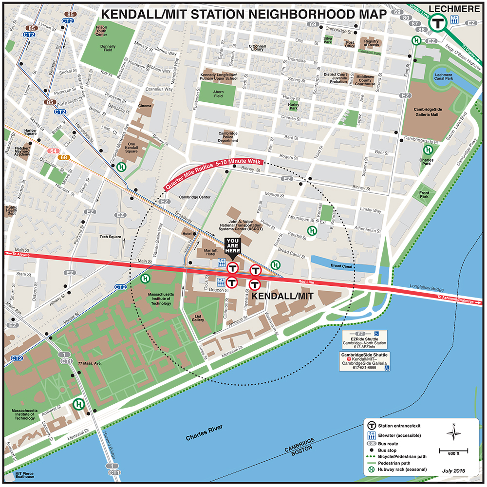
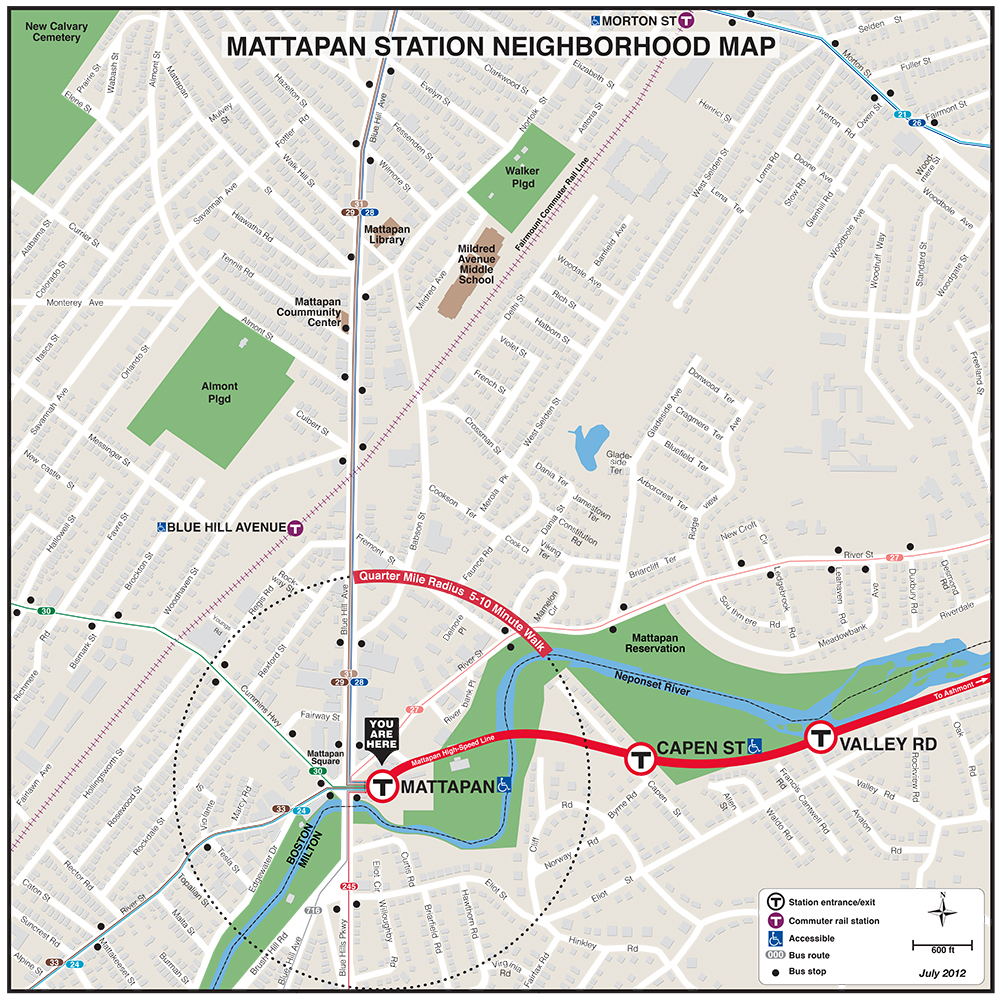
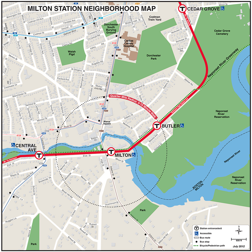
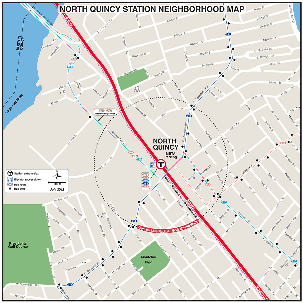
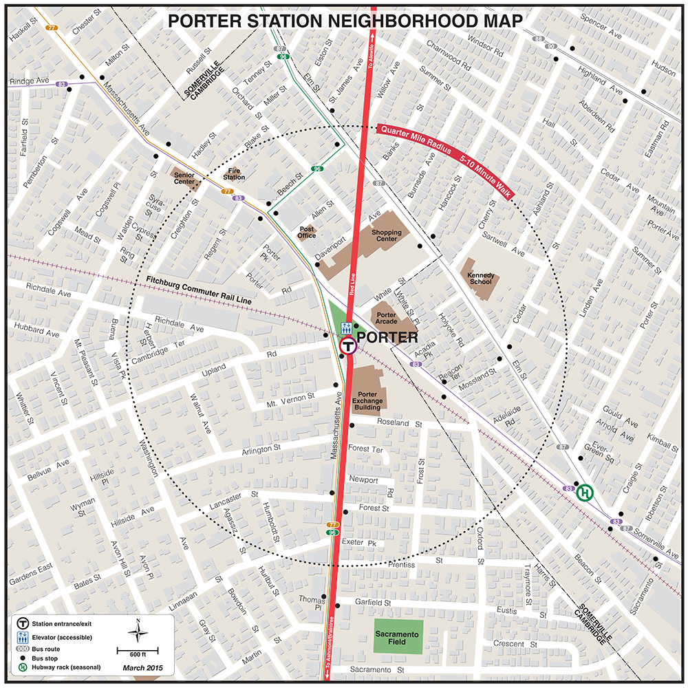
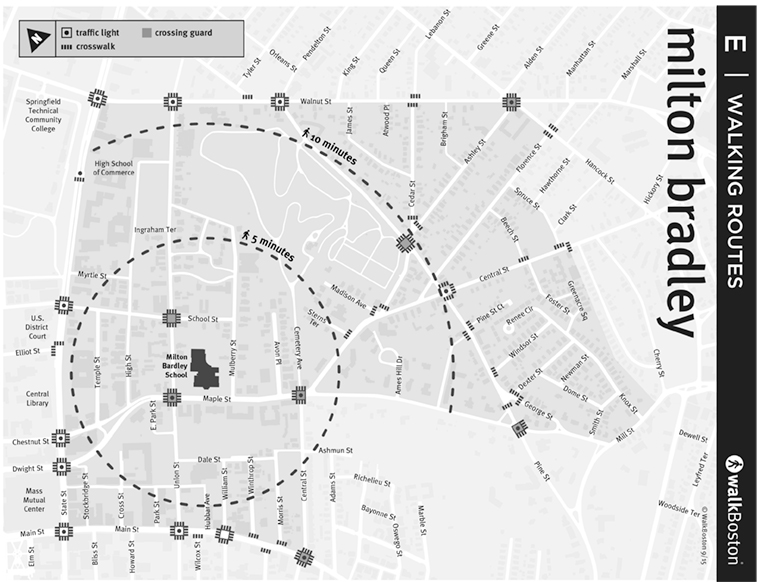
| Mattapan | Milton | North Quincy | Porter | Quincy Adams |
 |
 |
 |
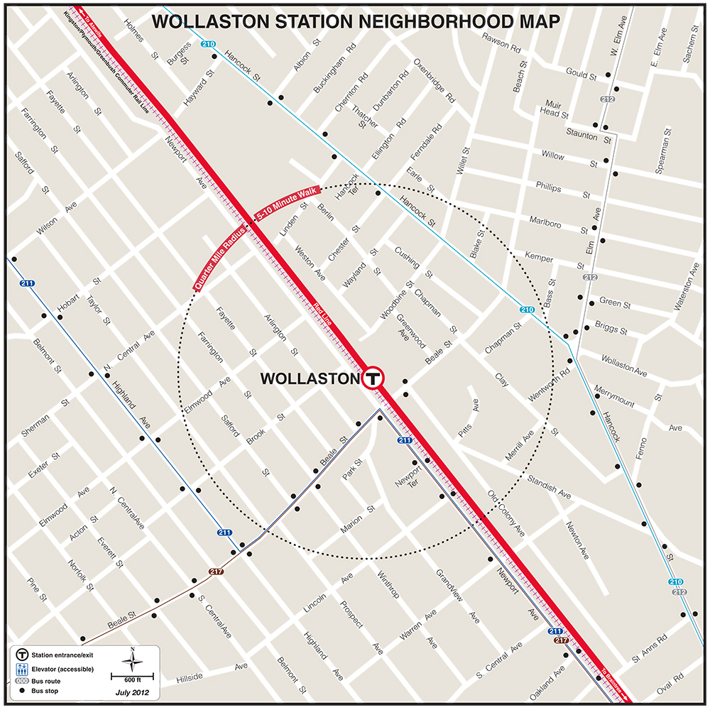 |
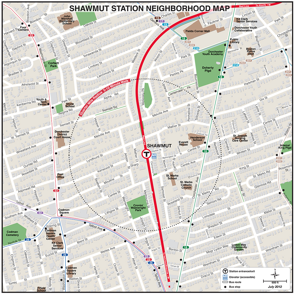
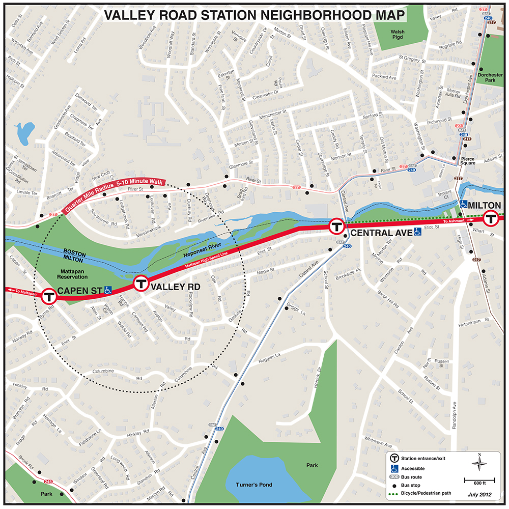
| Shawmut | Valley Road | Wollaston |
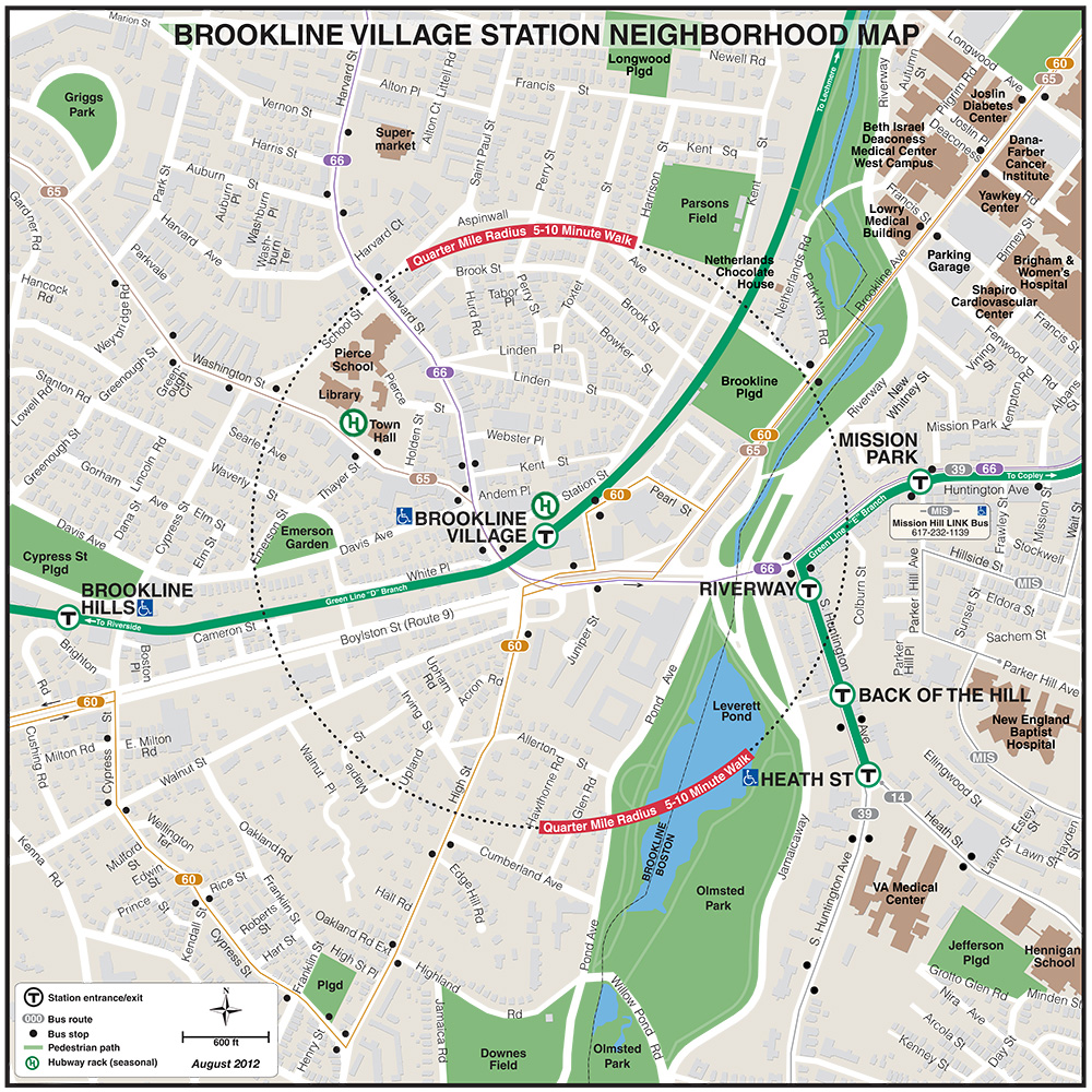
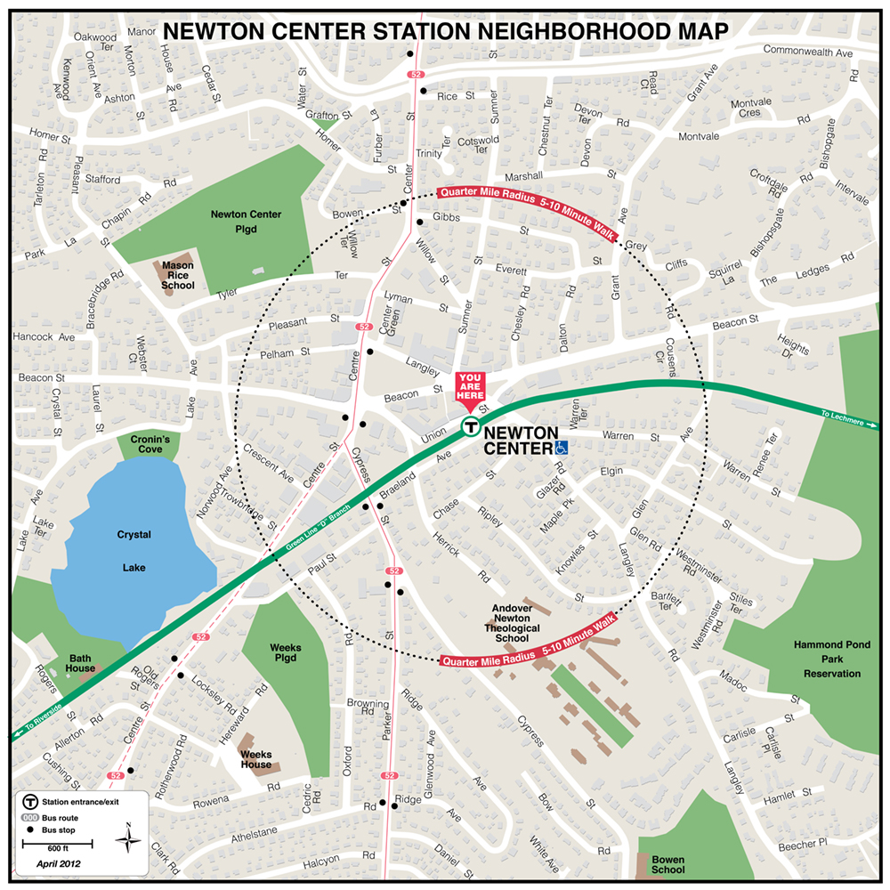
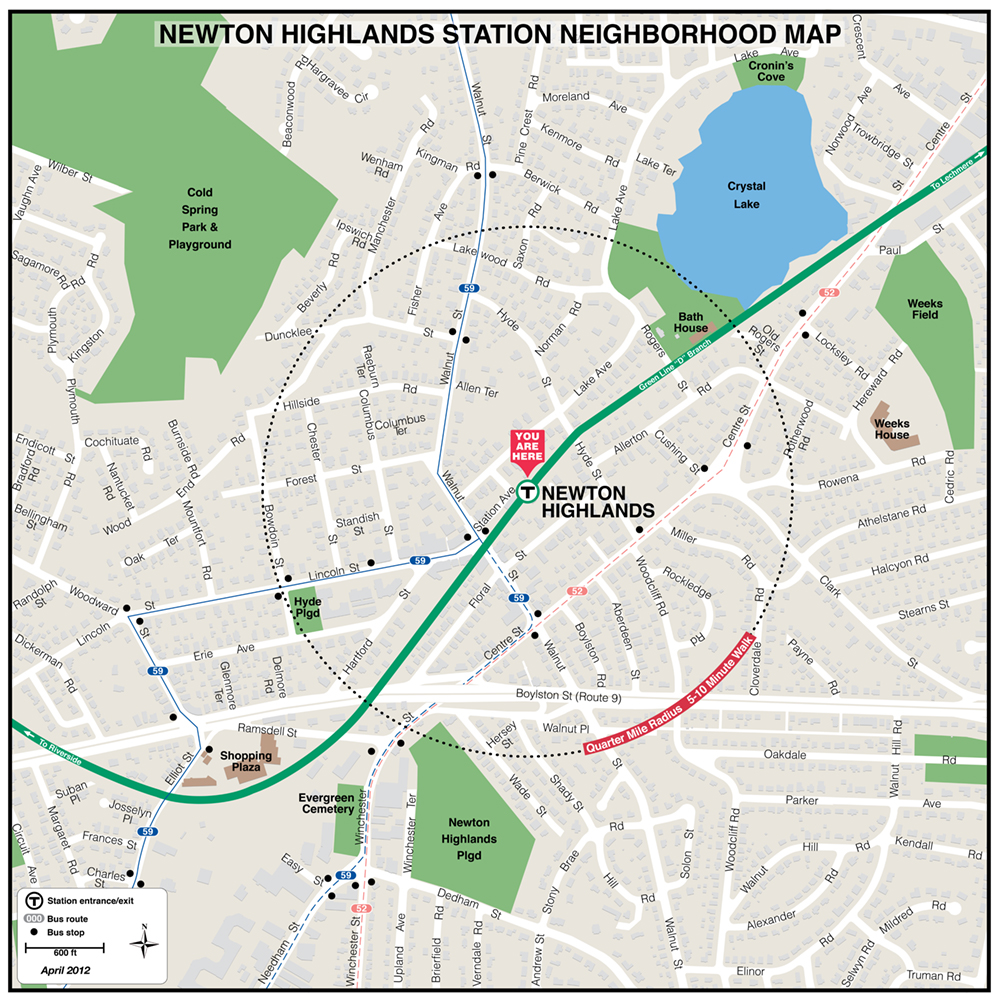
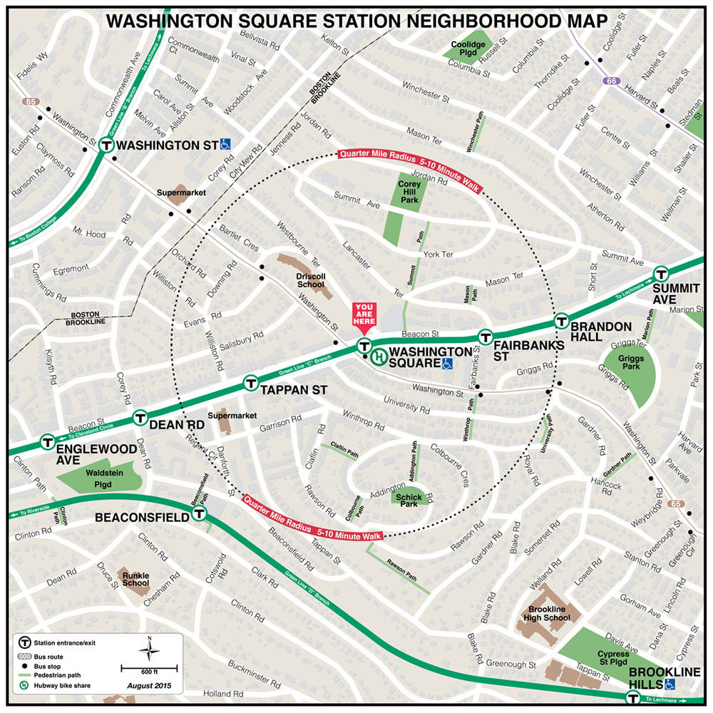
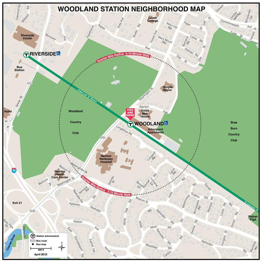
MBTA Green Line Neighborhood Maps
 |
 |
 |
 |
 |
 |
|
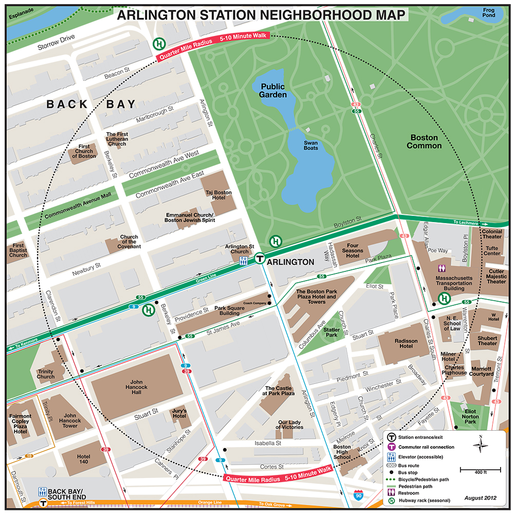
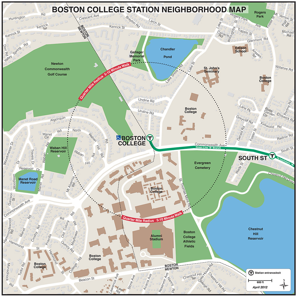
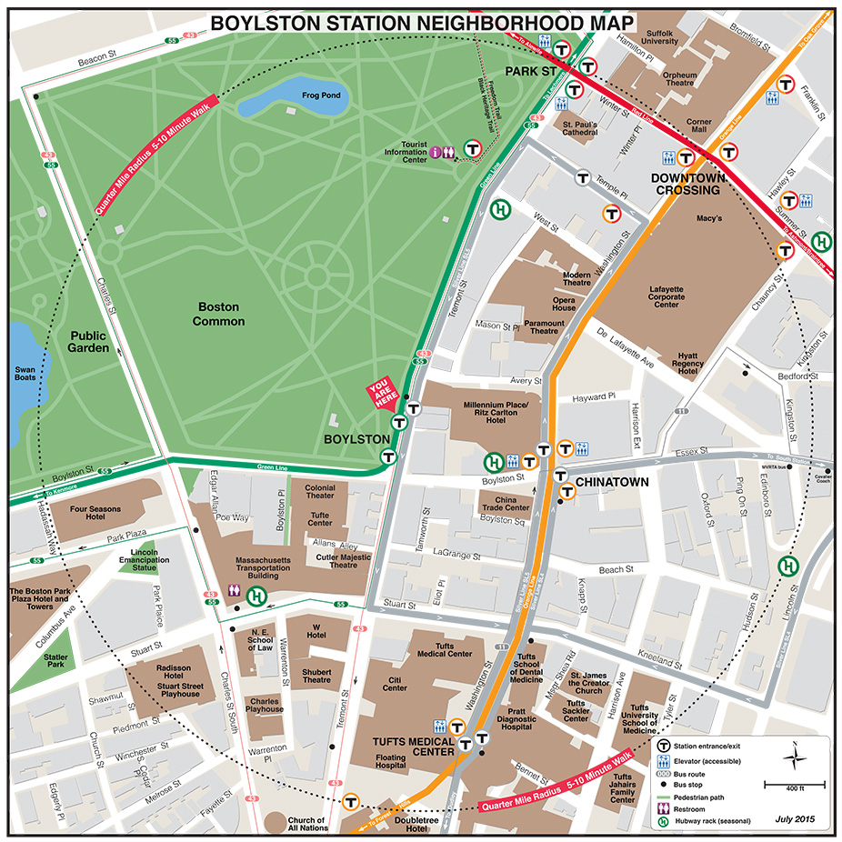
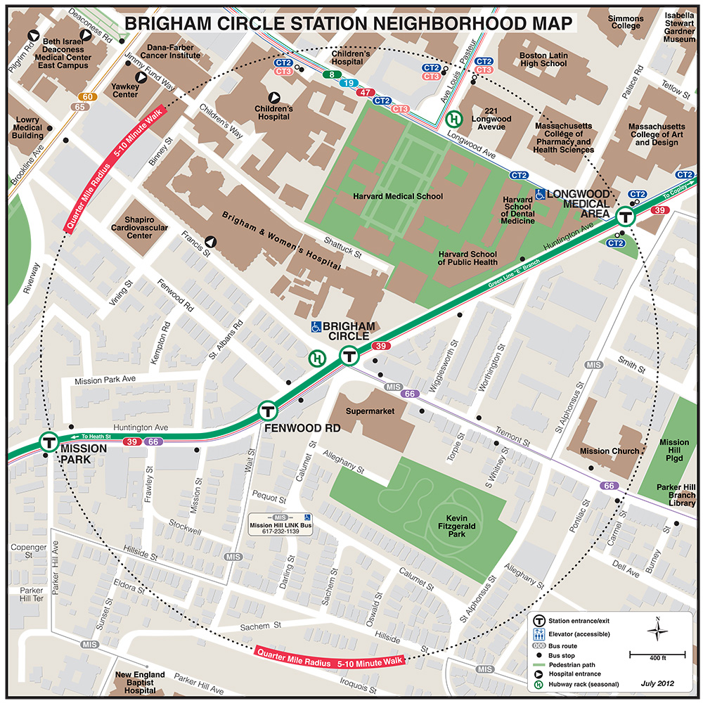
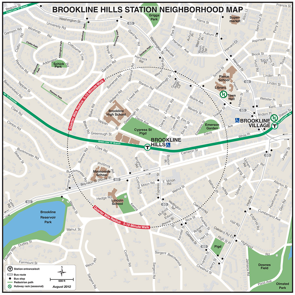
| Boston College | Beaconsfield | Boylston | Brigham Circle | Brookline Hills |
 |
 |
 |
 |
 |
 |
 |
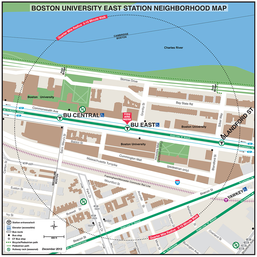
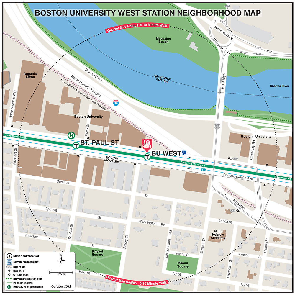
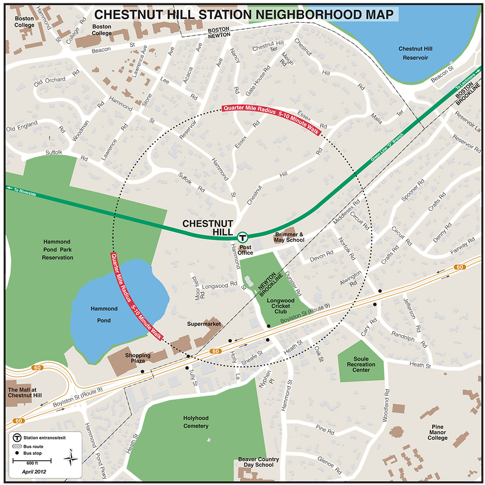
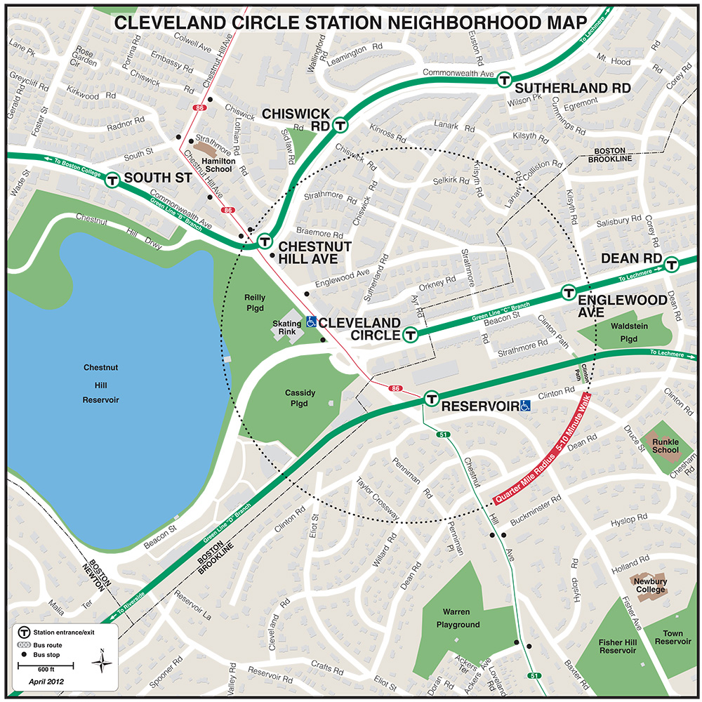
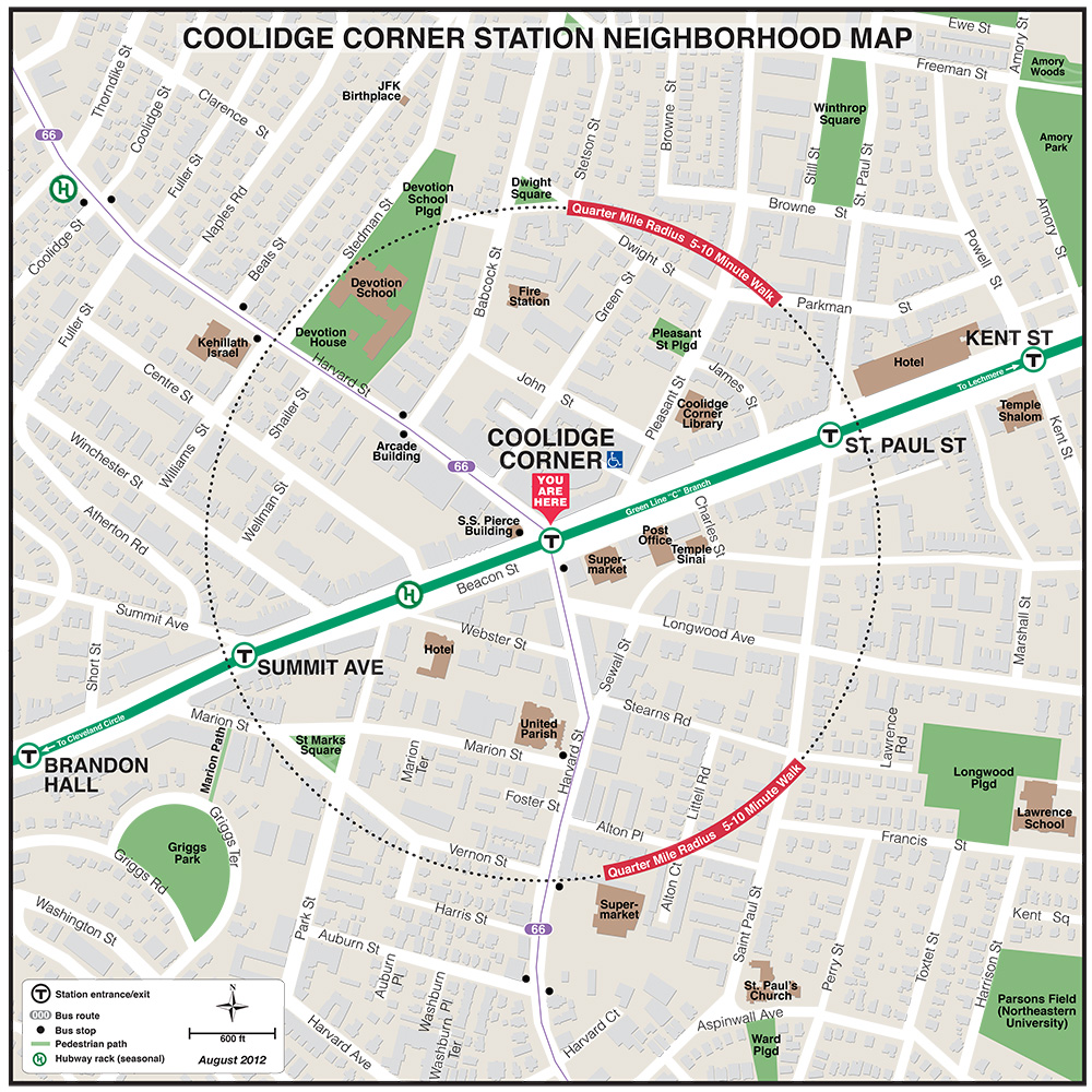
| BU East | BU West | Chestnut Hill | Cleveland Circle | Coolidge Corner |
 |
 |
 |
 |
 |
 |
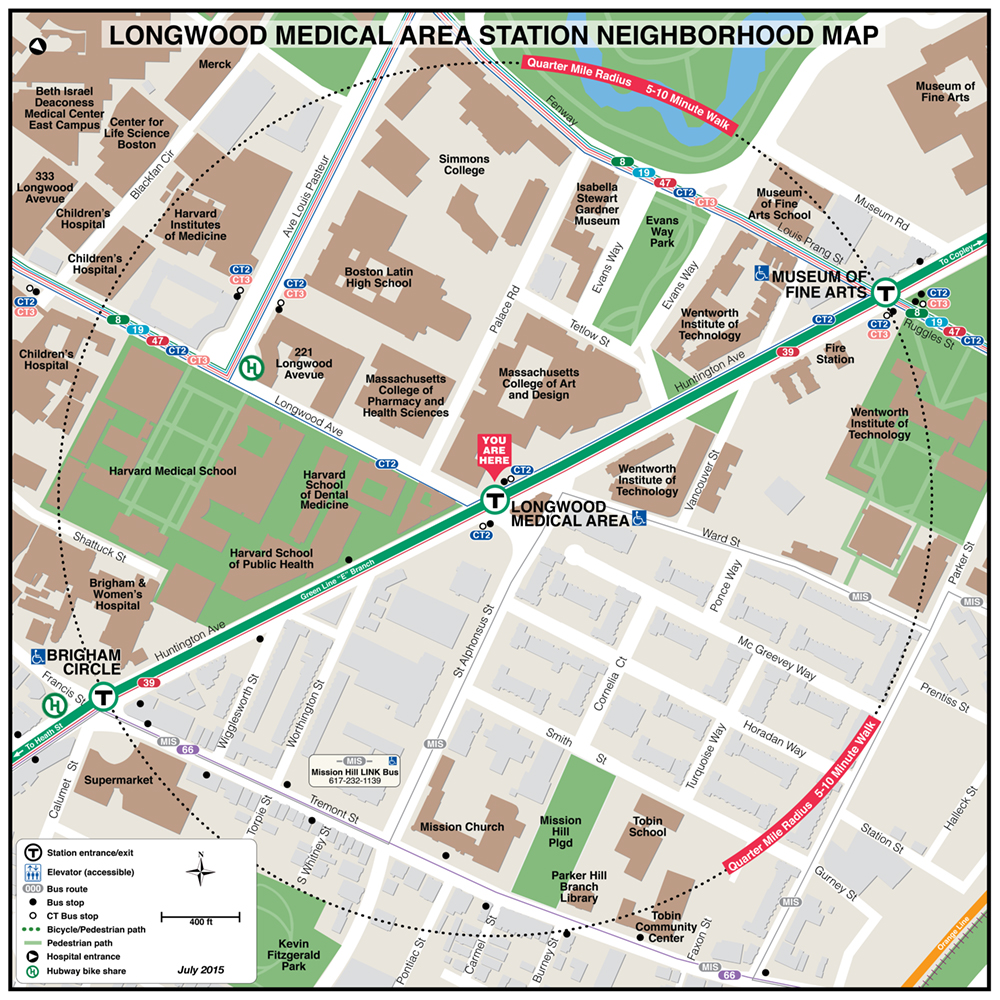 |
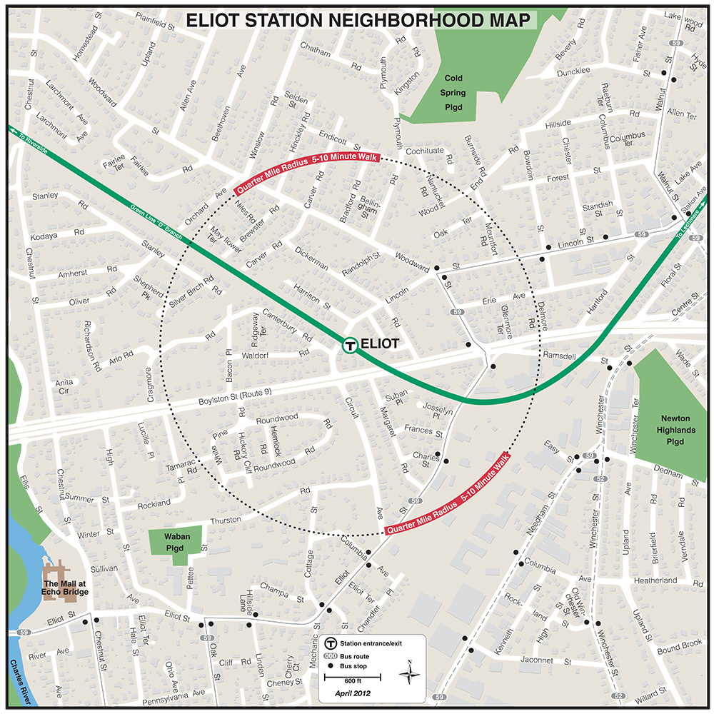
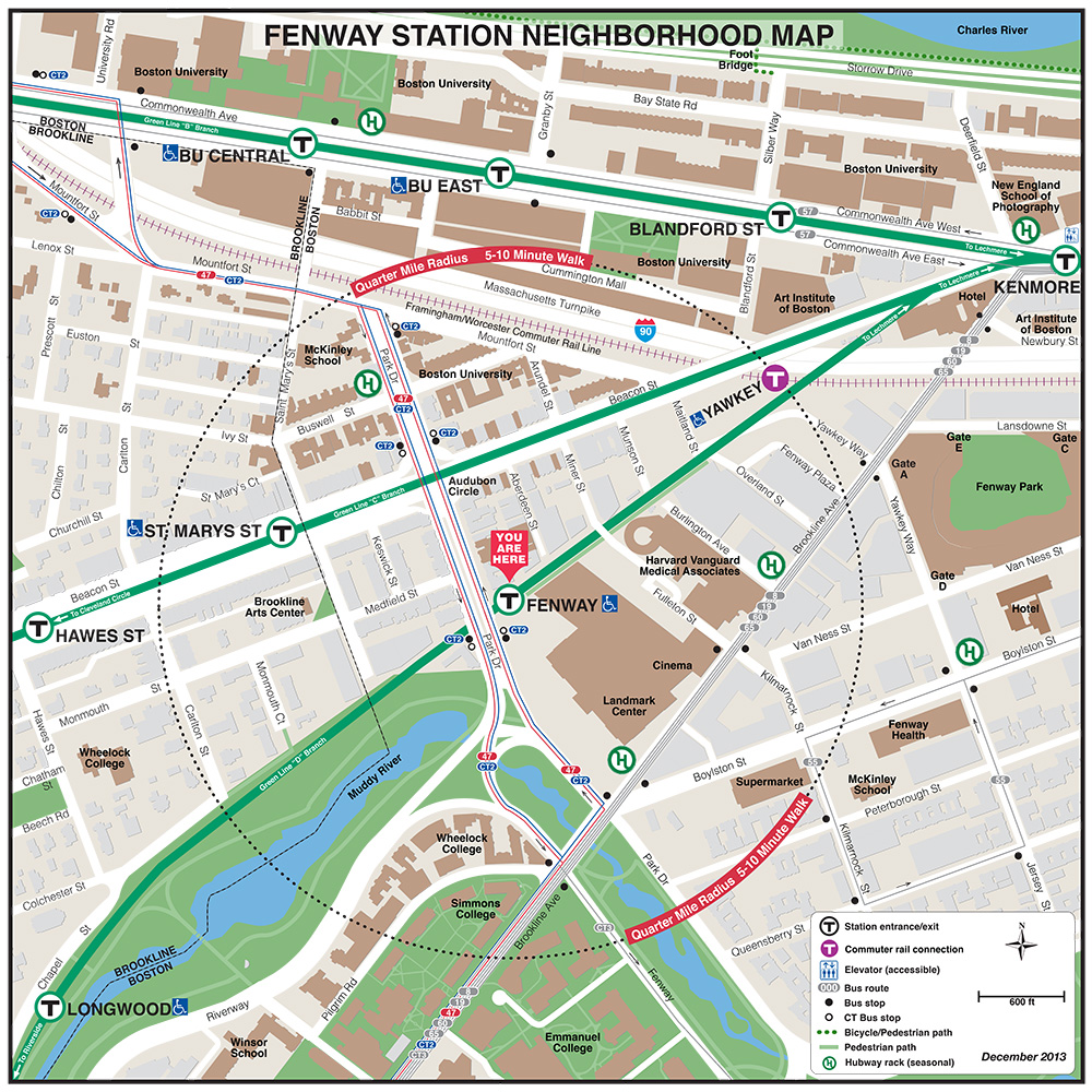
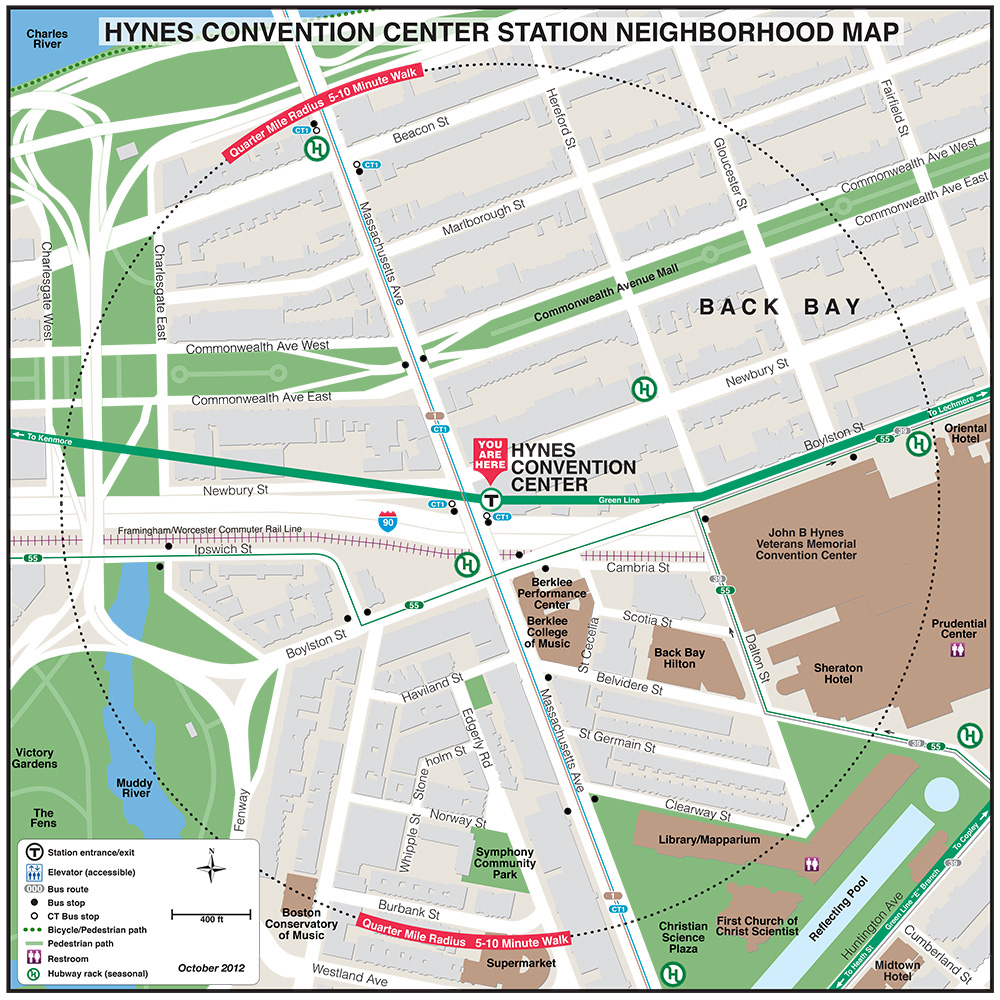
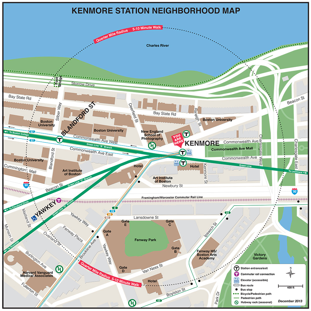
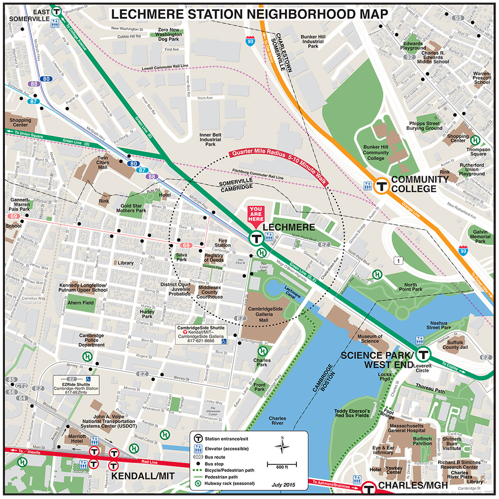
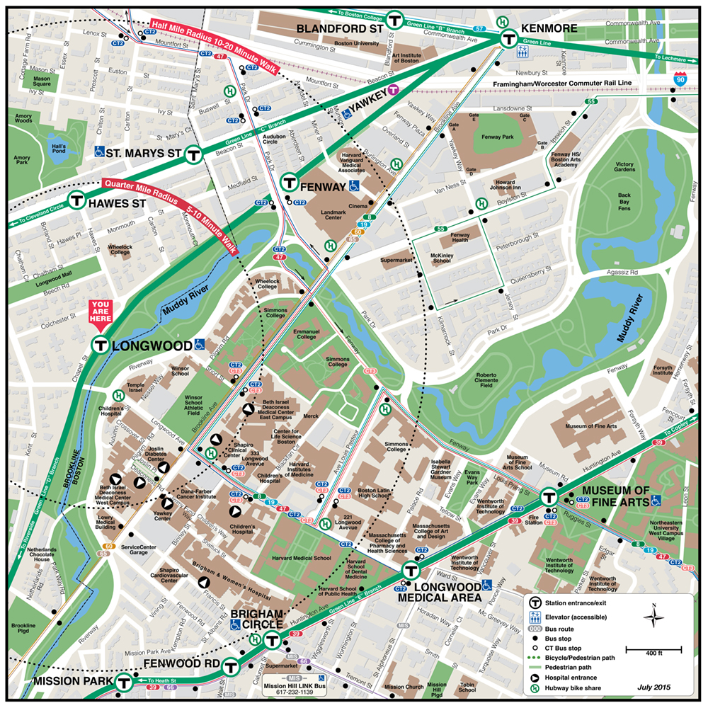
| Fenway | Kenmore | Lechmere | Longwood |
 |
 |
 |
 |
 |
 |
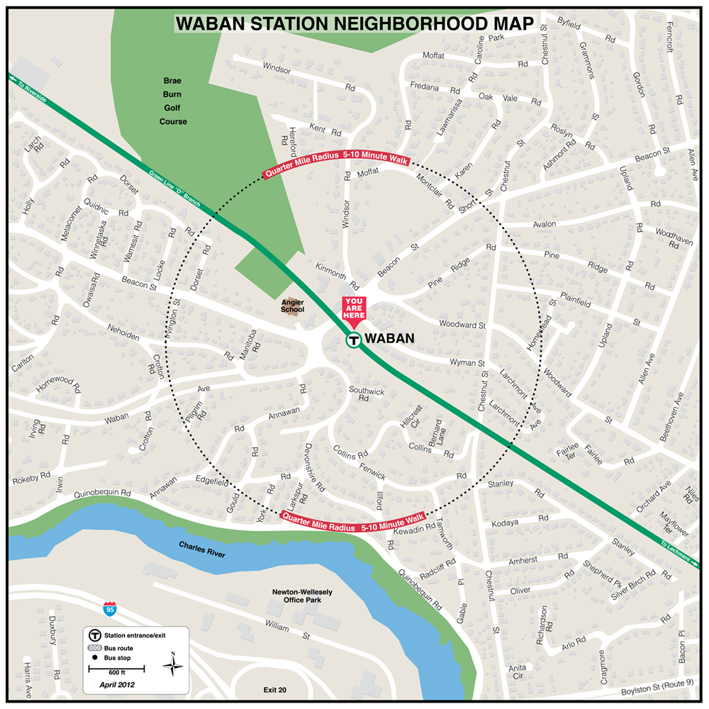 |
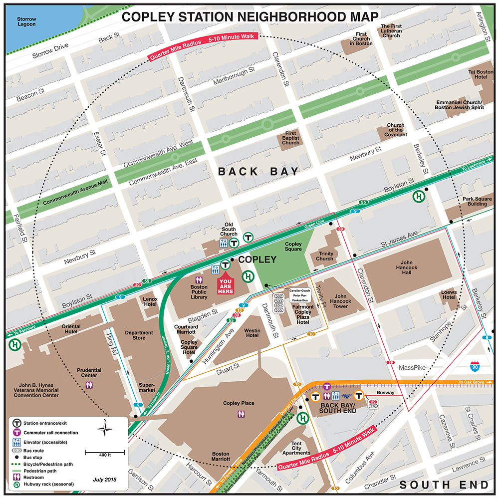
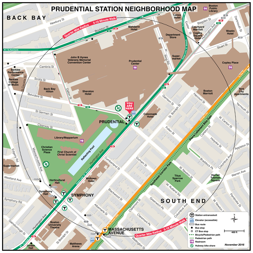
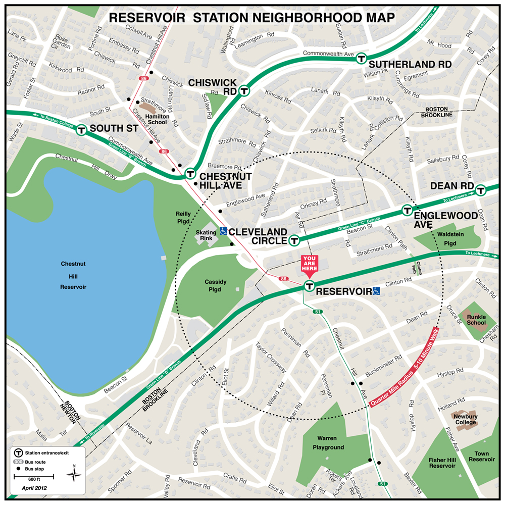
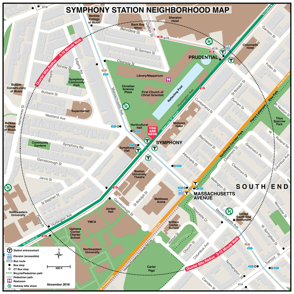
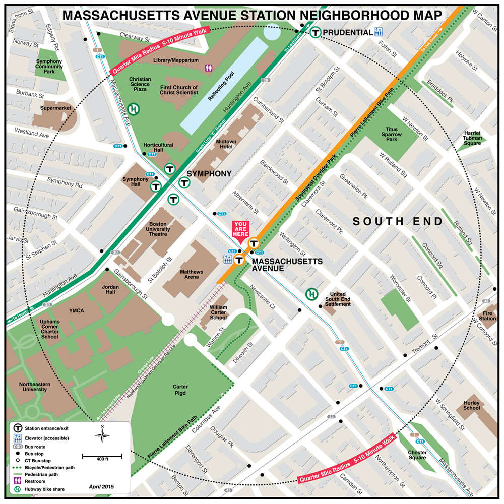
| Newton Centre | Prudential | Reservoir | Symphony |
 |
|
 |
| Washington St. |
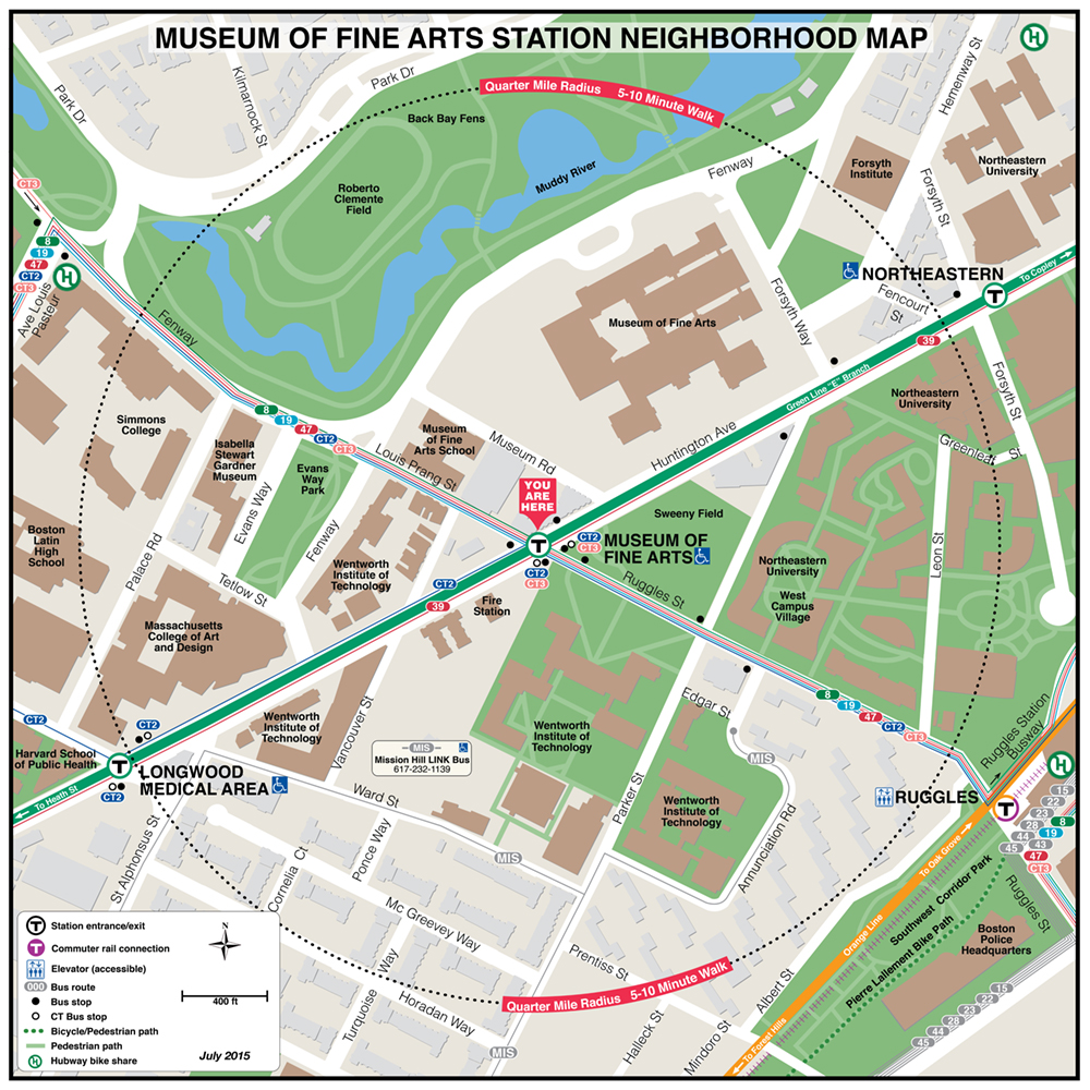
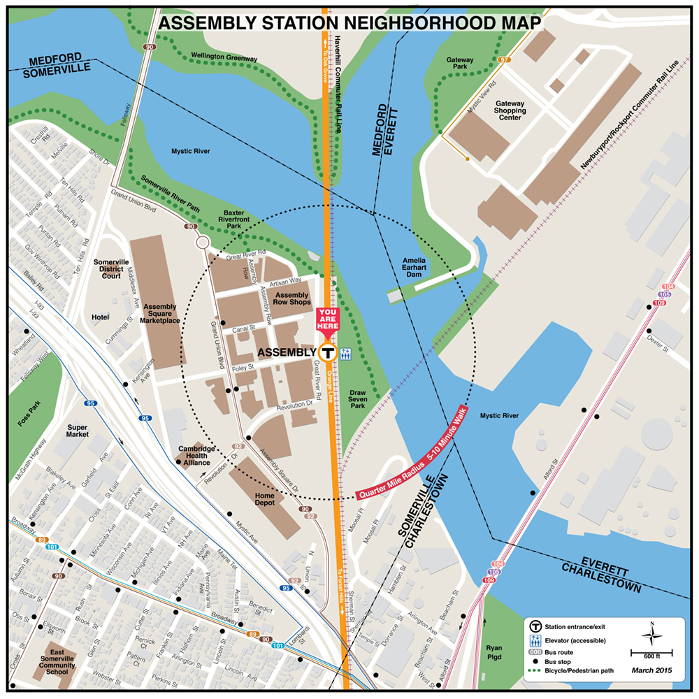
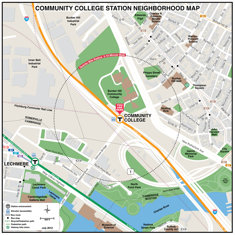
MBTA Orange Line Neighborhood Maps
 |
 |
 |
 |
 |
 |
 |
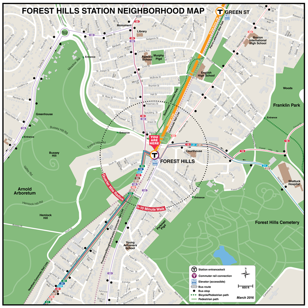
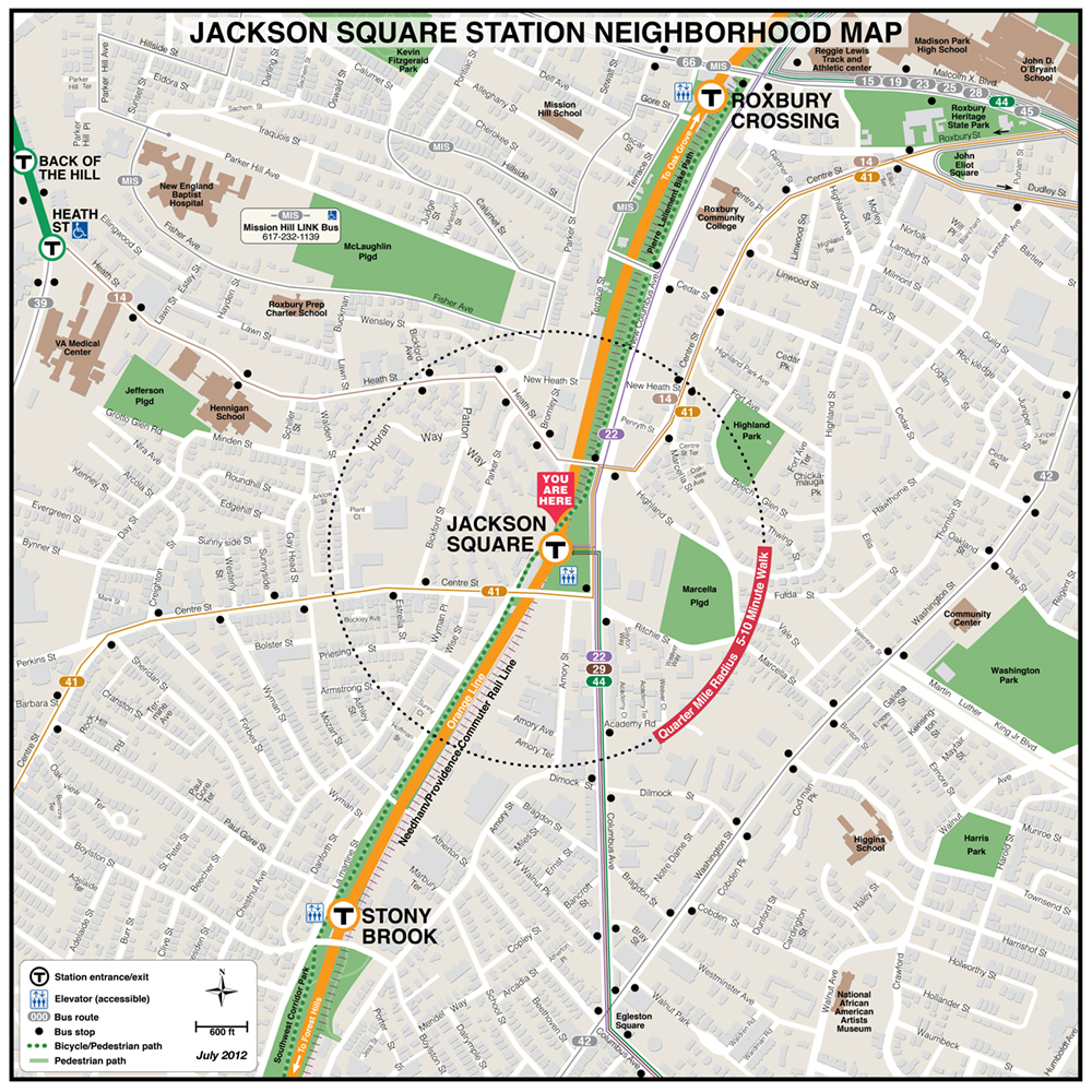
| Back Bay | Community College | Forest Hills | Green Street | Jackson Square |
 |
 |
 |
 |
 |
 |
 |
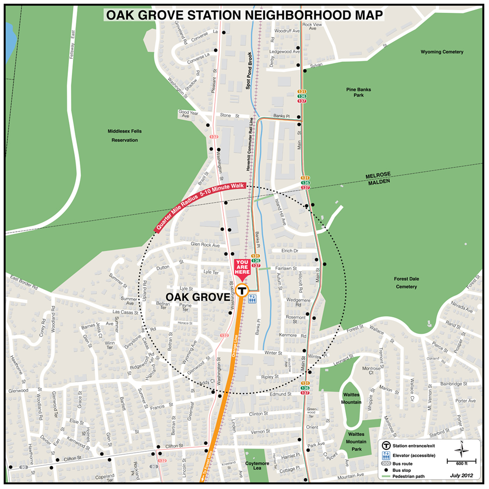
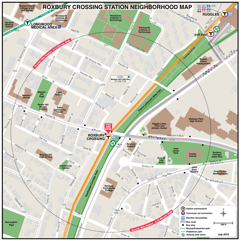
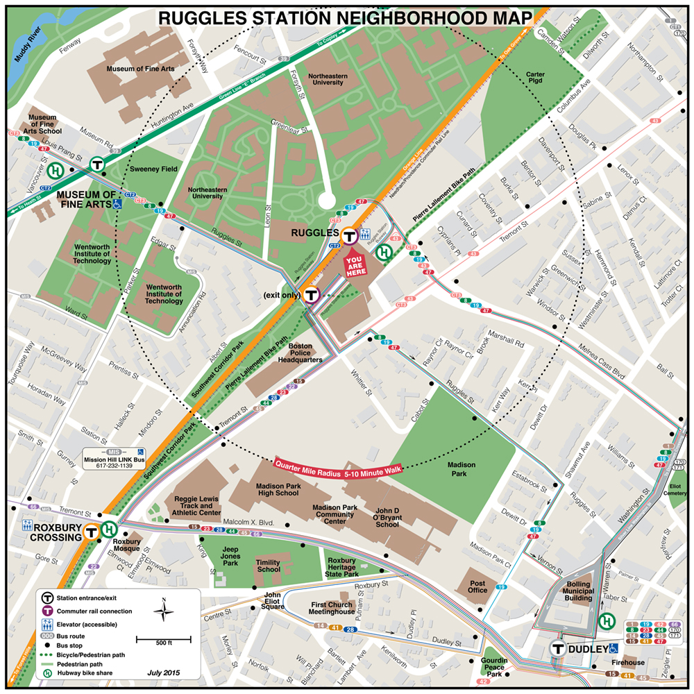
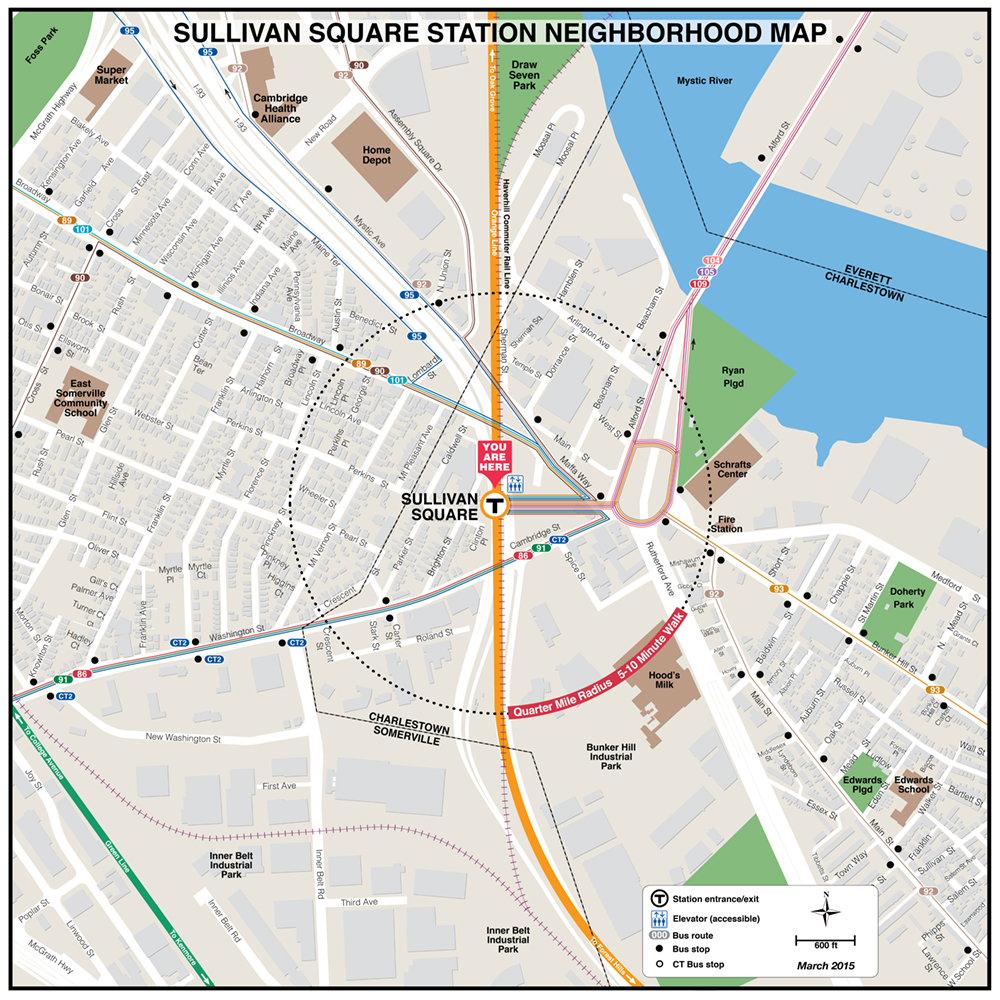
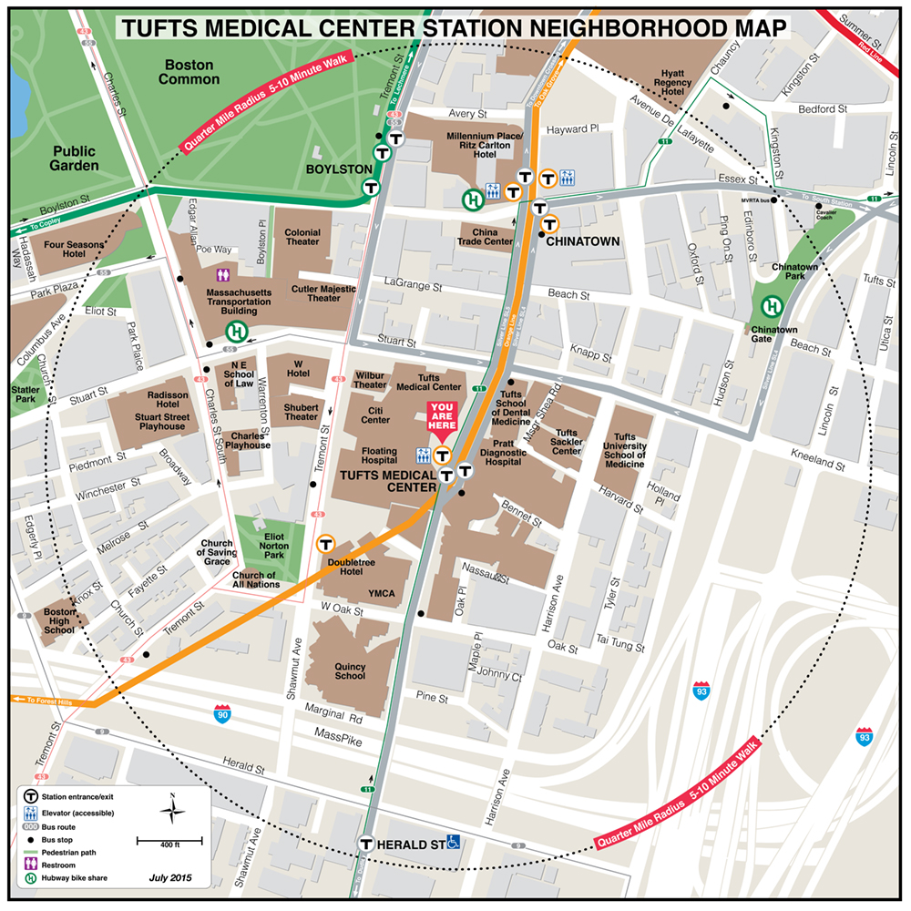
| Oak Grove | Roxbury Crossing | Ruggles | Sullivan Square | Tufts Medical Ctr. |
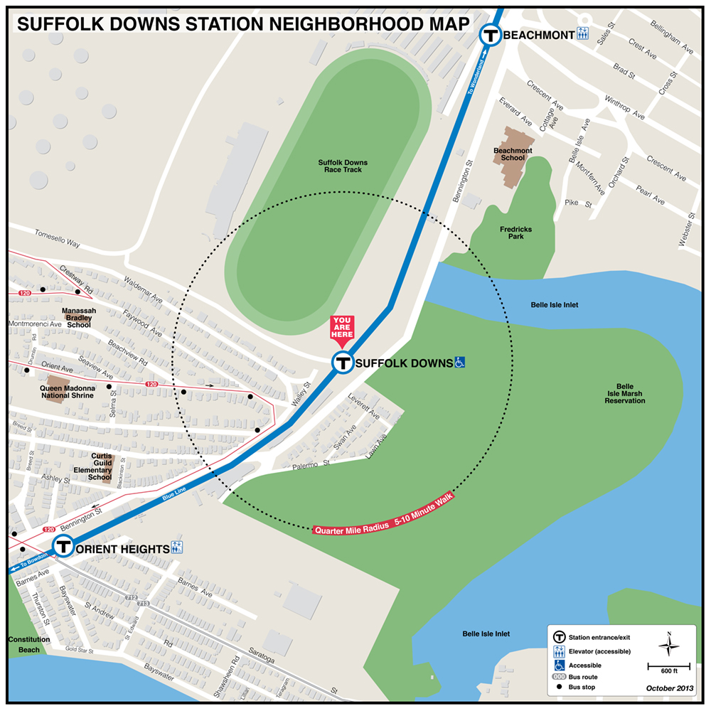
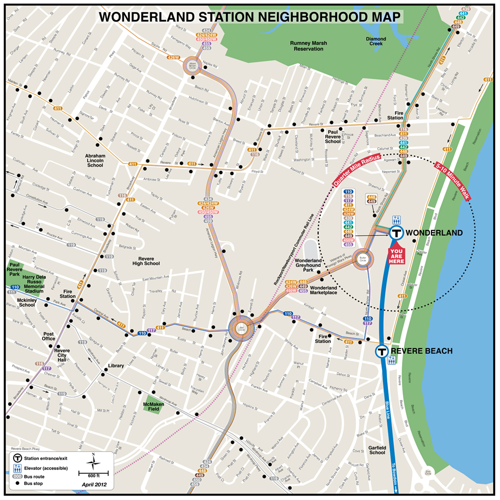
MBTA Blue Line Neighborhood Maps
 |
 |
 |
 |
 |
 |
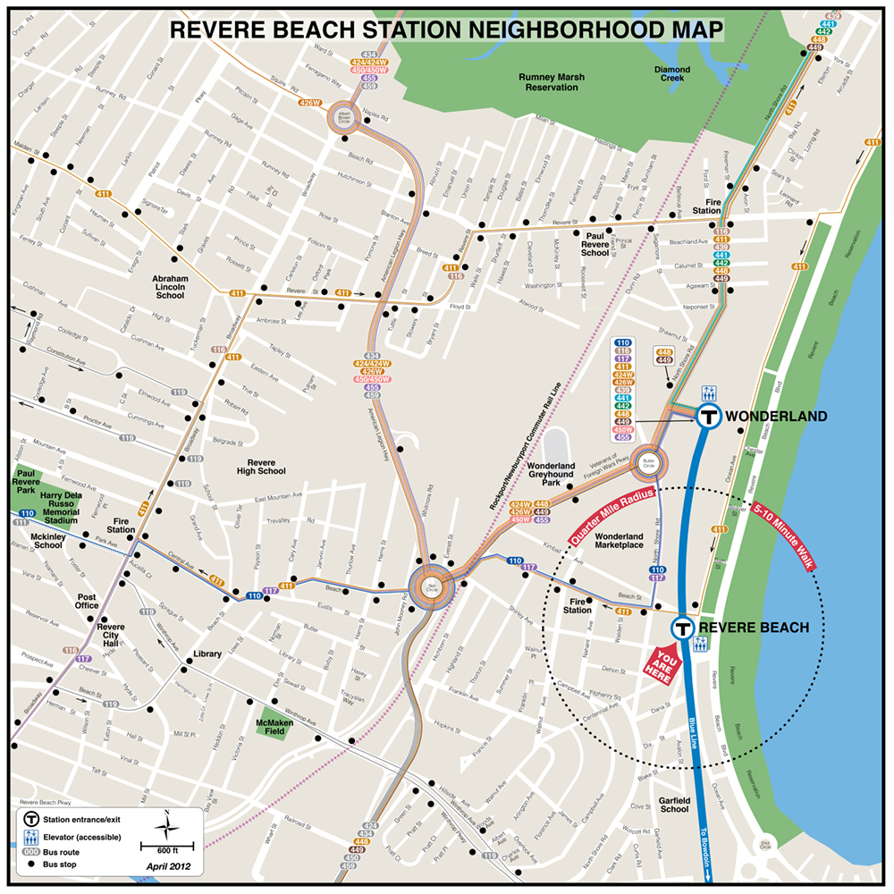 |
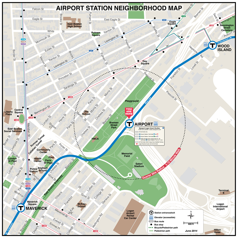
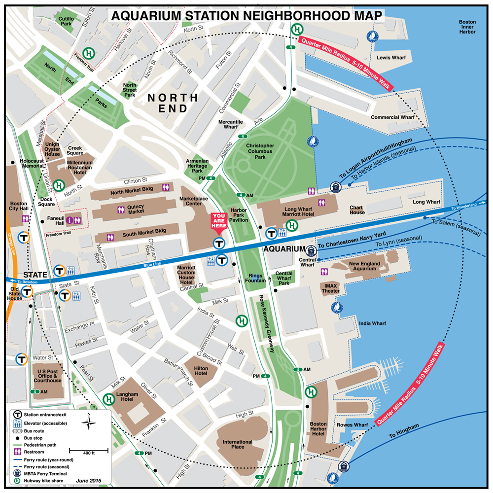
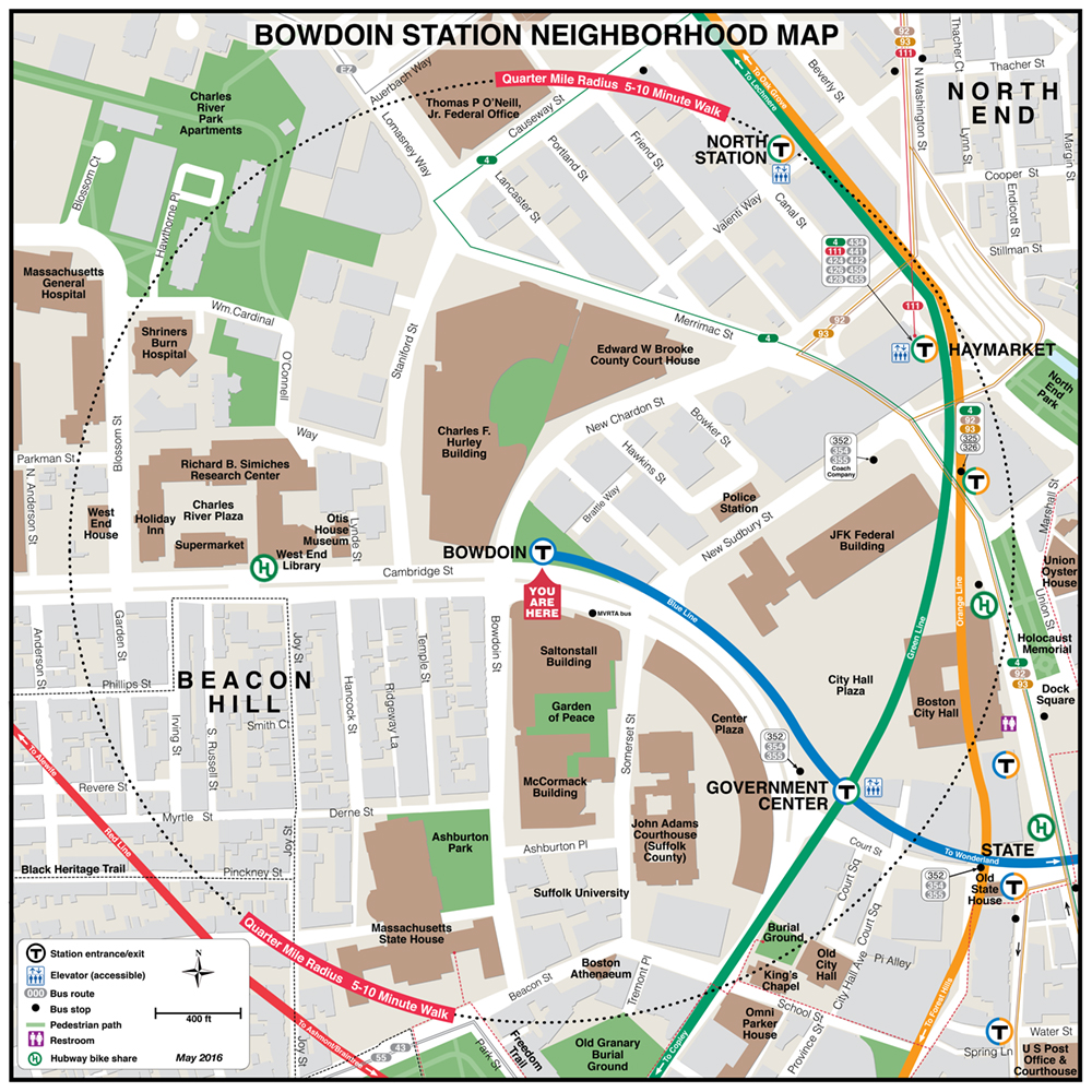
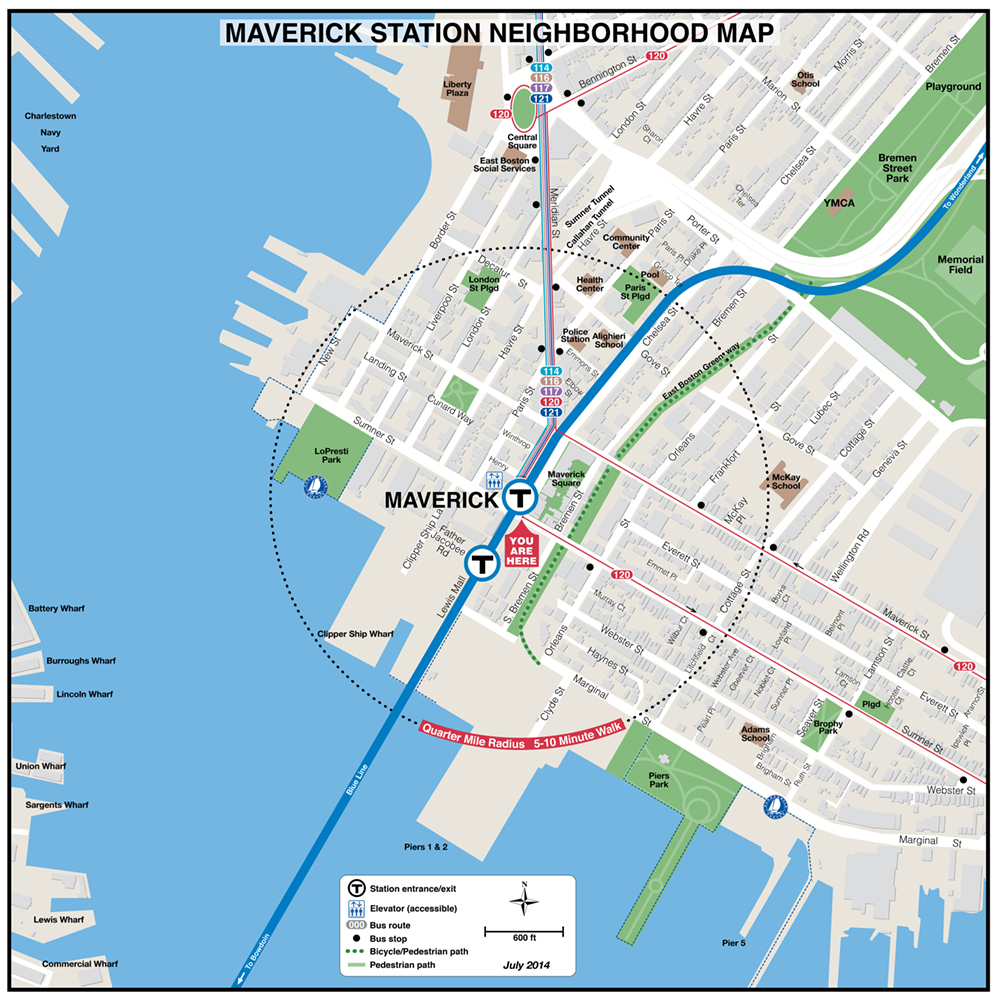
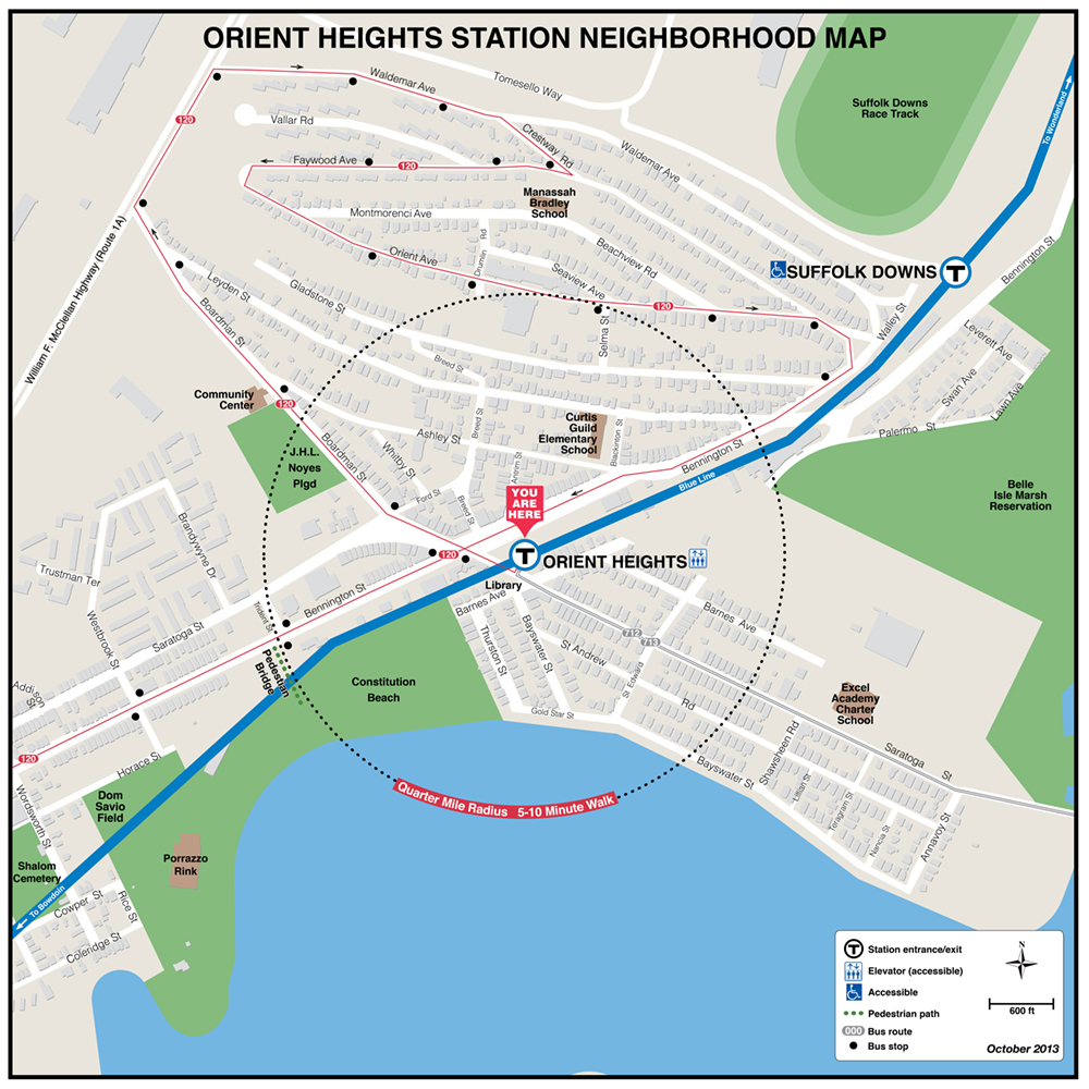
| Aquarium | Beachmont | Bowdoin | Maverick | Orient Heights |
 |
 |
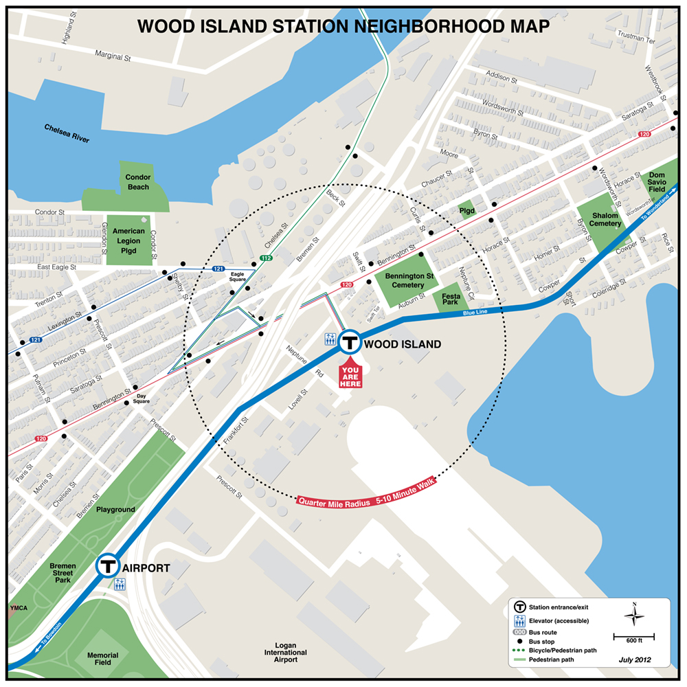 |
| Wonderland | Wood Island |
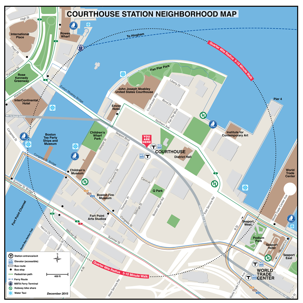
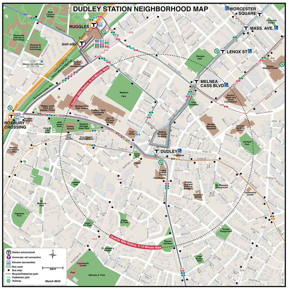
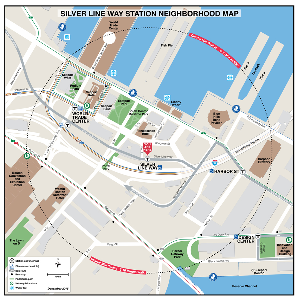
MBTA Silver Line Neighborhood Maps
 |
 |
 |
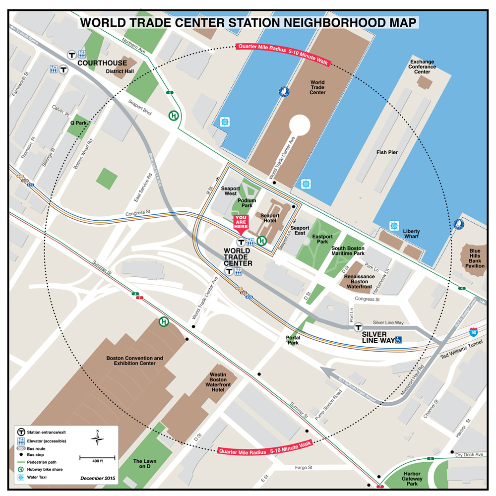 |
| Dudley | Silver Line Way | World Trade Center |
 |
 |
|
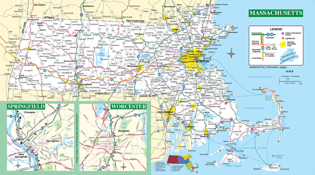
| Massachusetts Office of Travel and Tourism Getaway Guide Official Massachusetts State Map |
 |
.jpg) |
.jpg) |
 |
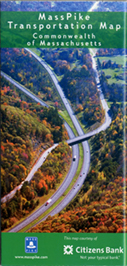
Cover |
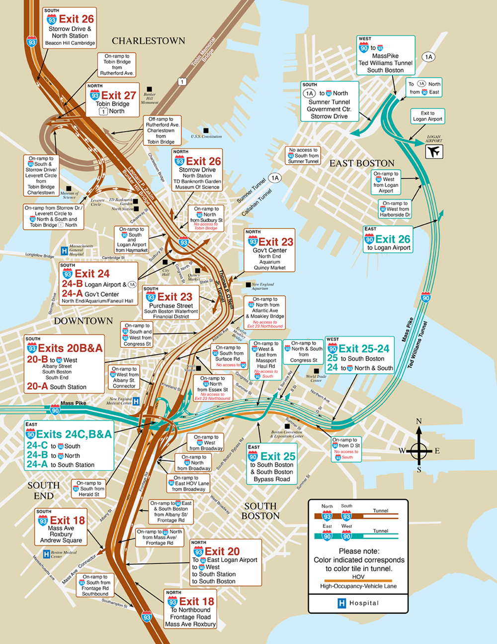
The MassPike Map 1997-2007–Front |
The MassPike Map 1997-2007–Back | New Exits Insert |
 |
 |
 |
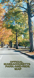
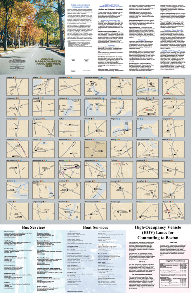
Cover |
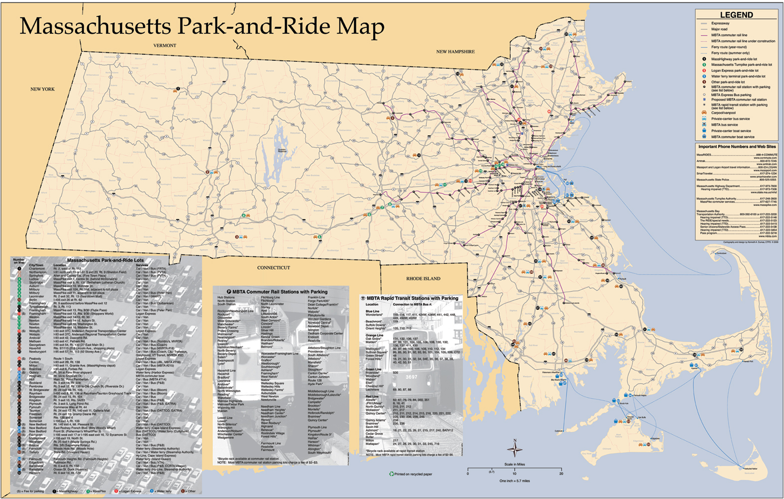
The Massachusetts Park-and-Ride Map |
The Massachusetts Park-and-Ride Map 1997-2007–Back |
 |
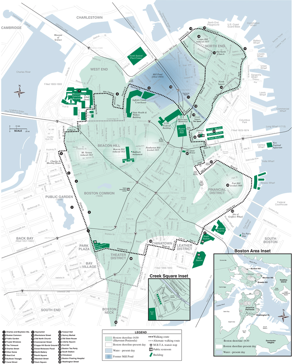 |
Cover |
Shawmut Peninsula Walk Map |
Projects/products I consulted on.
 |
 |
 |
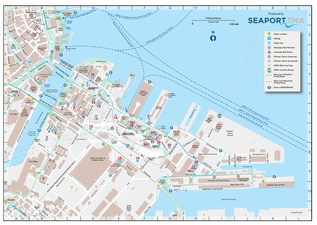 |
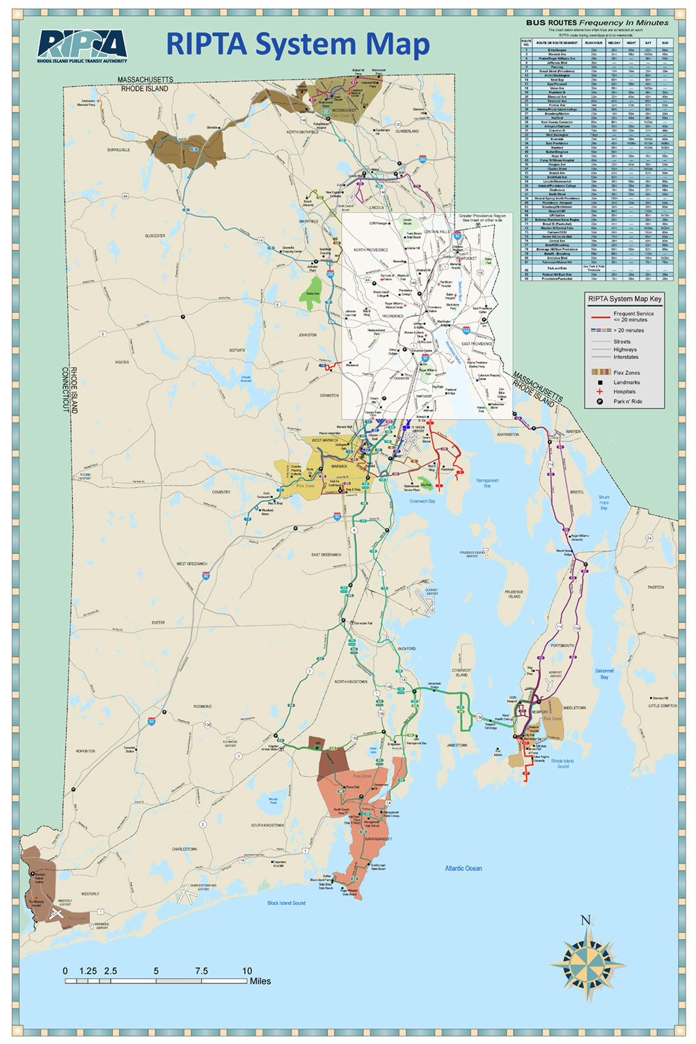
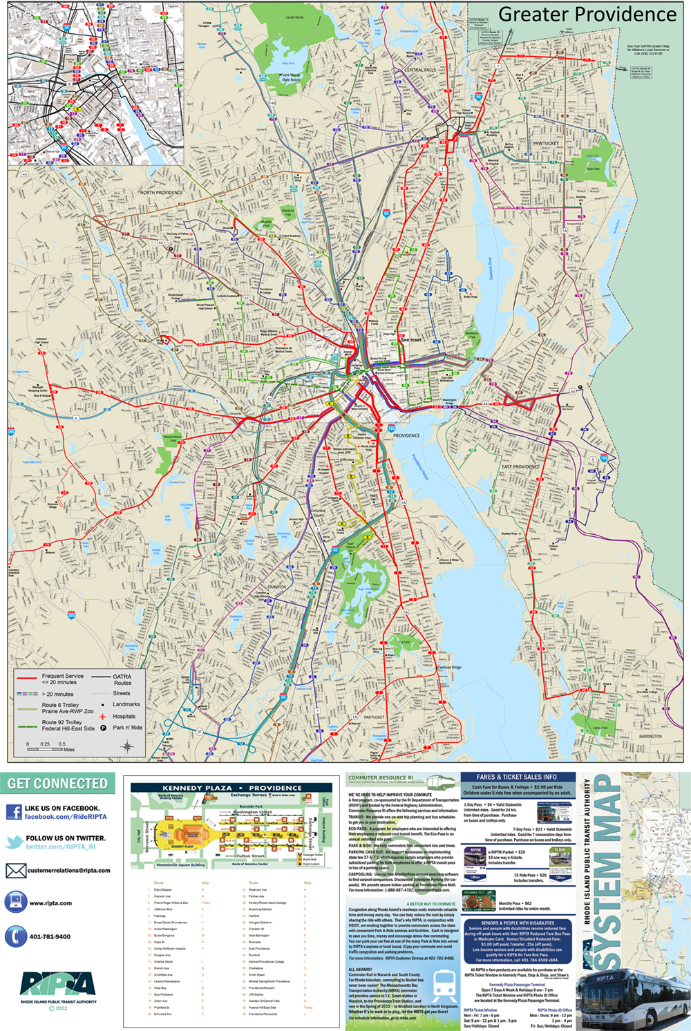
| RIPTA Map–Front | RIPTA Map–Back | Seaport TMA Map |
 |
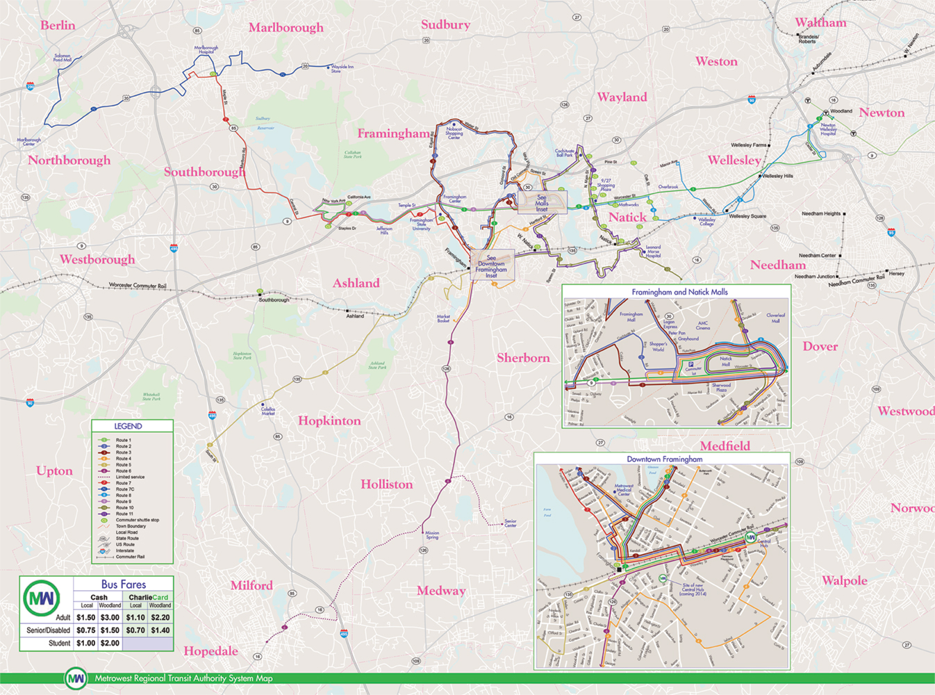 |
| Metrowest Transit Authority System Map |
 |
 |
 |
 |
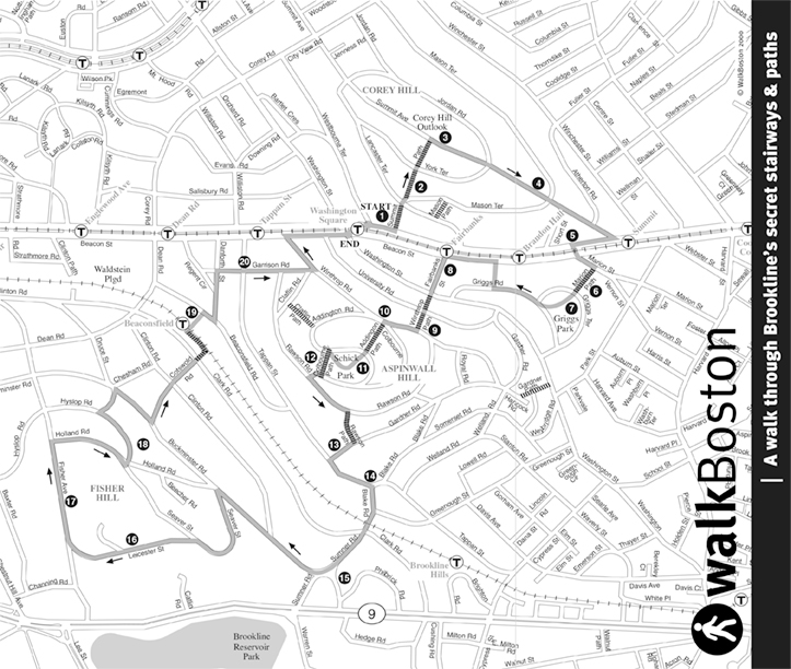 |
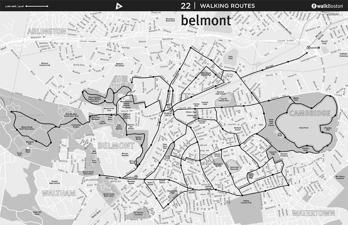
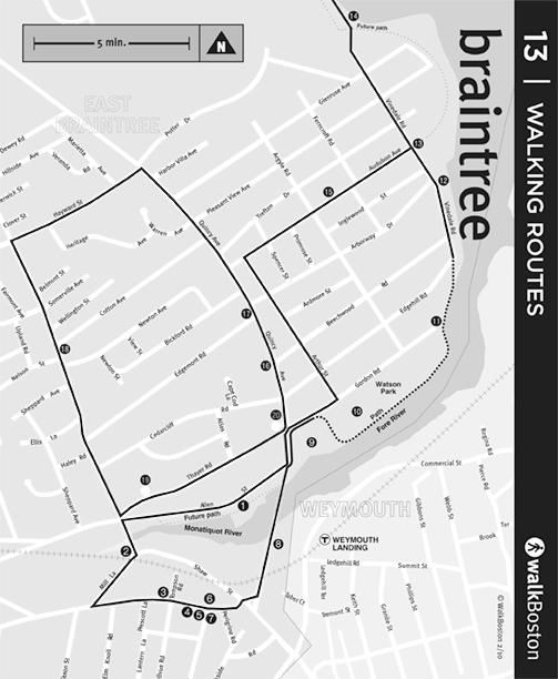
| Belmont | Boston Waterfront | Braintree | Brookline Paths |
 |
 |
 |
 |
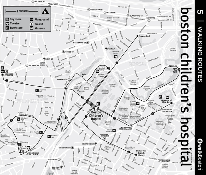 |
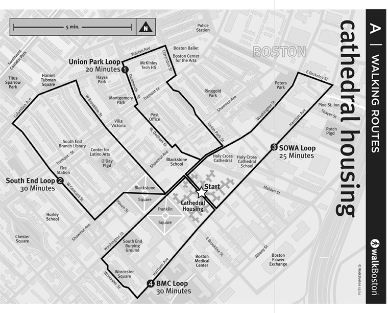
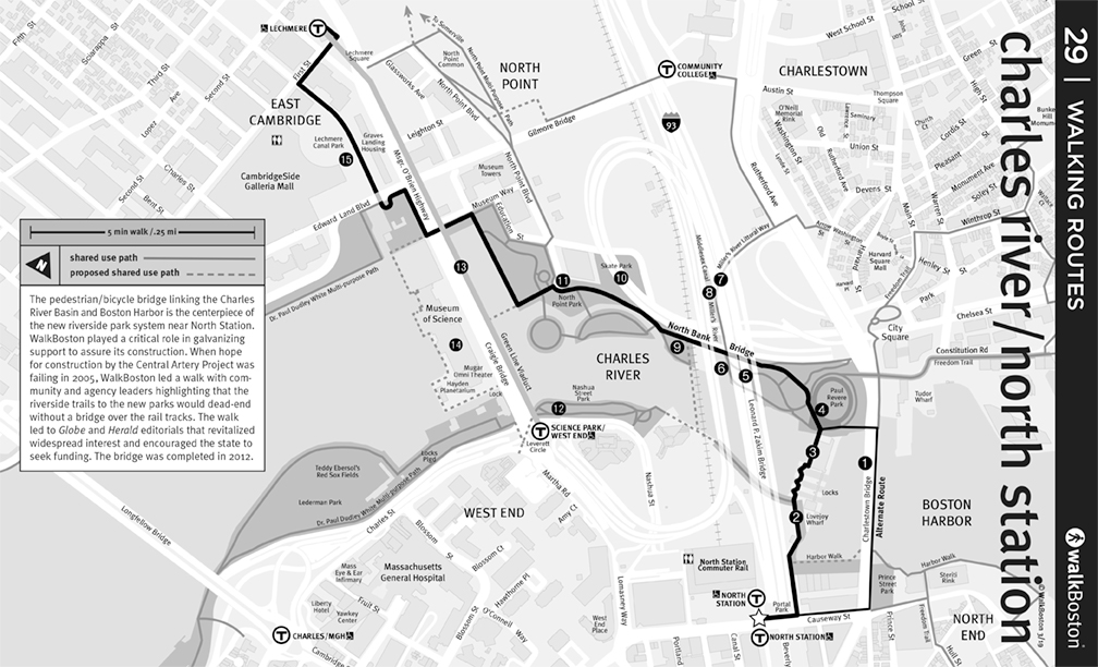
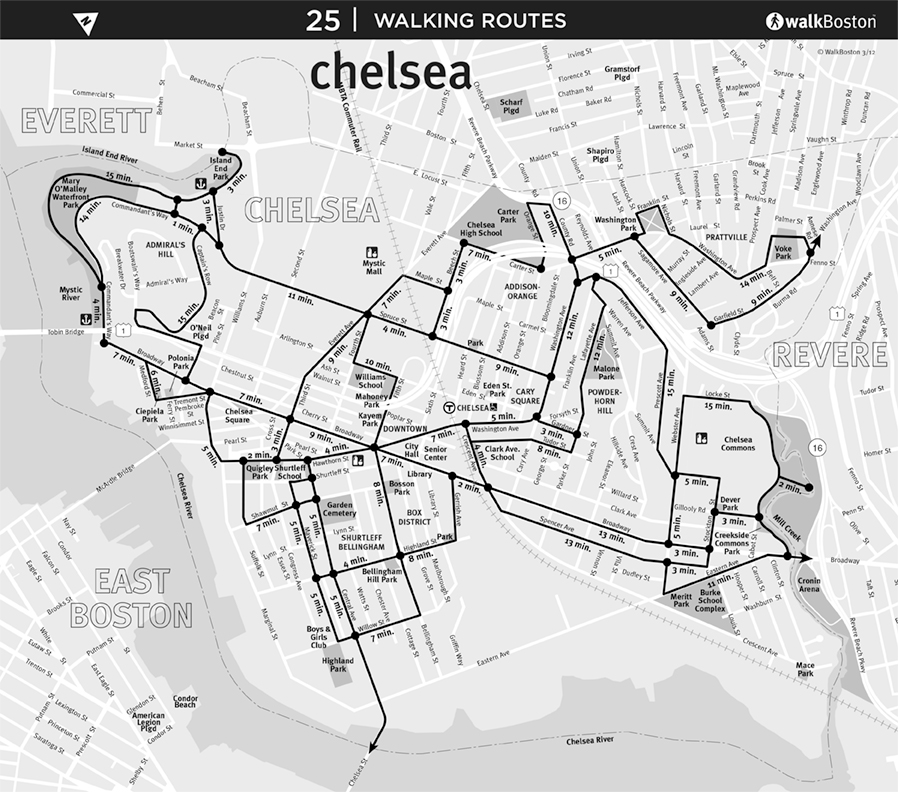
| Cathedral Housing | Charles River/North Station | Chelsea | Children's Hospital |
 |
 |
 |
 |
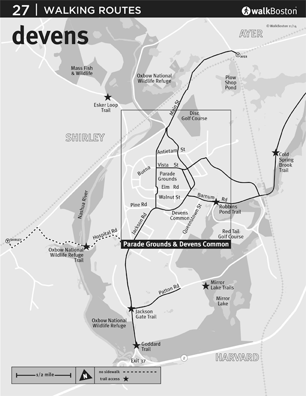 |
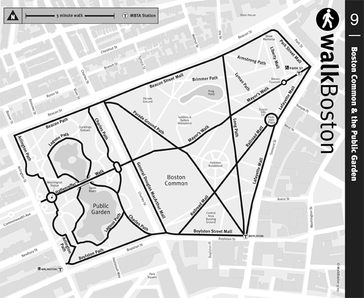
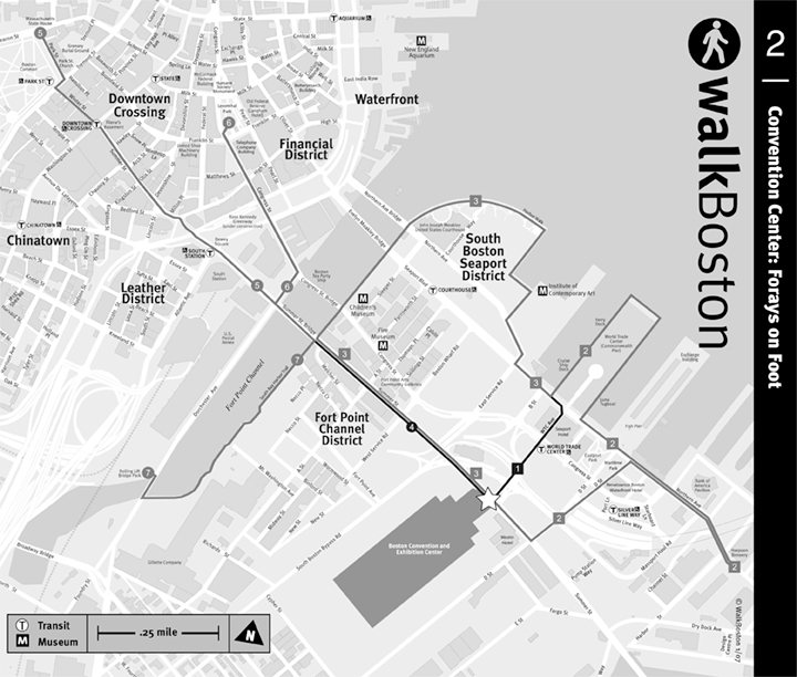
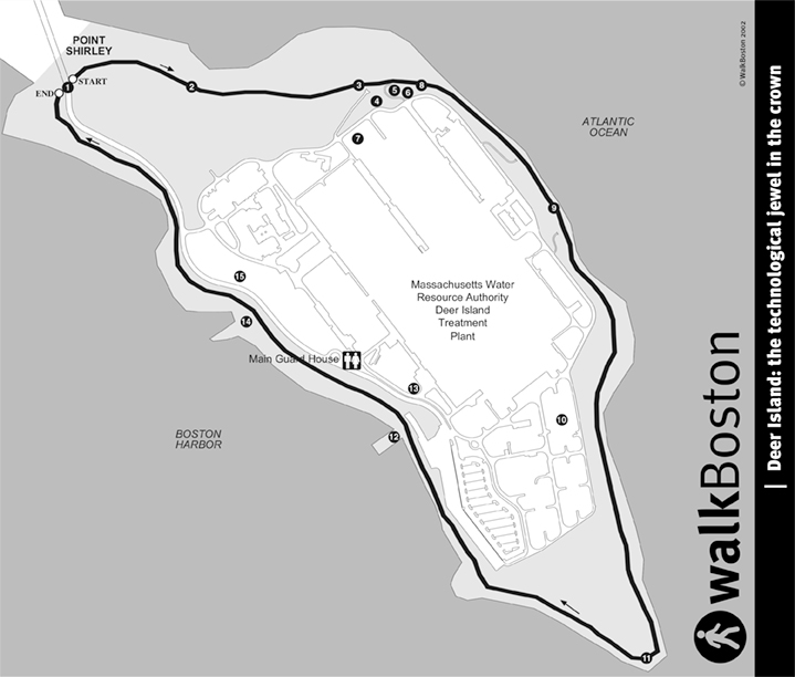
| Common/Public Garden | Convention Center | Deer Island | Devens |
 |
 |
 |
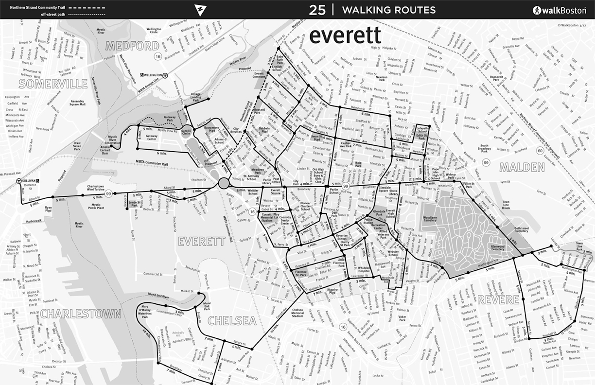 |
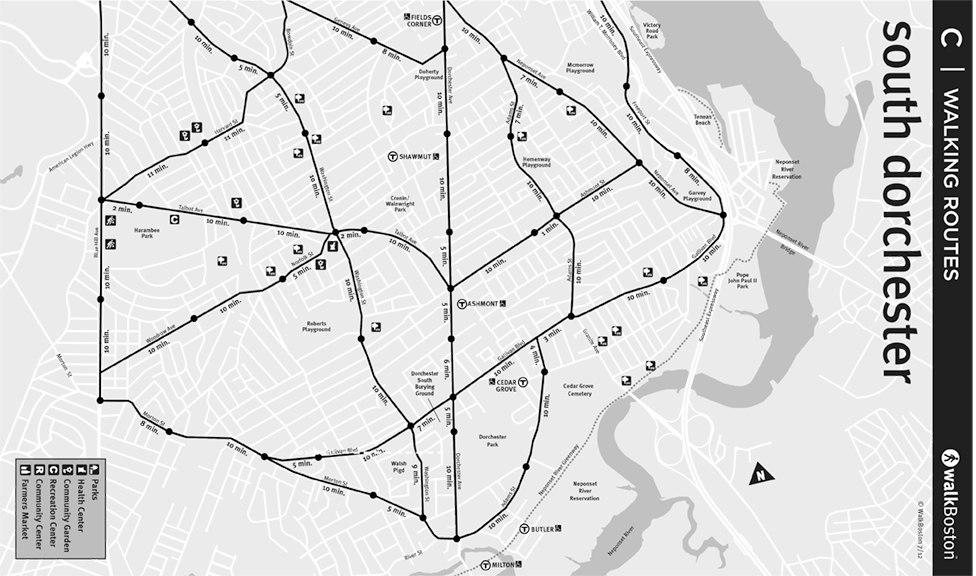
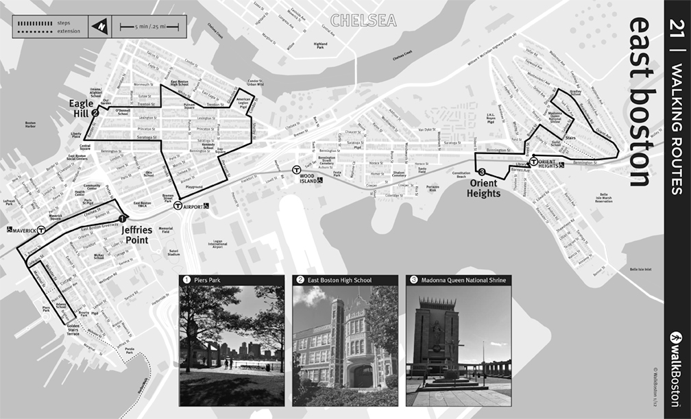
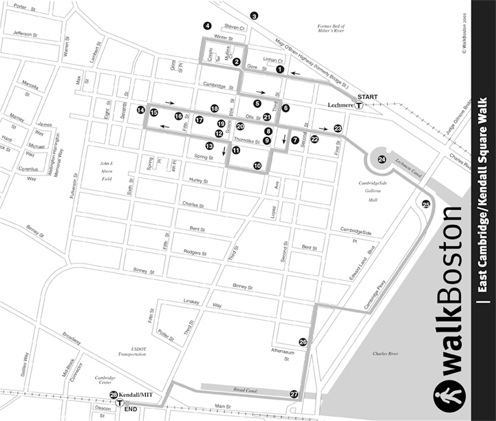
| East Boston | East Cambridge | Everett |
 |
 |
 |
 |
 |
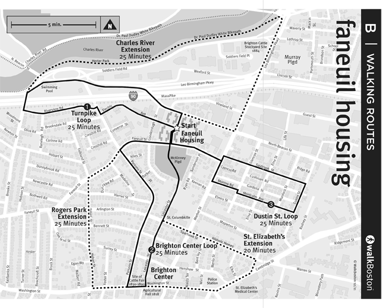
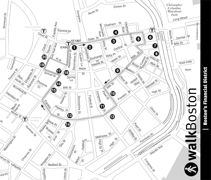
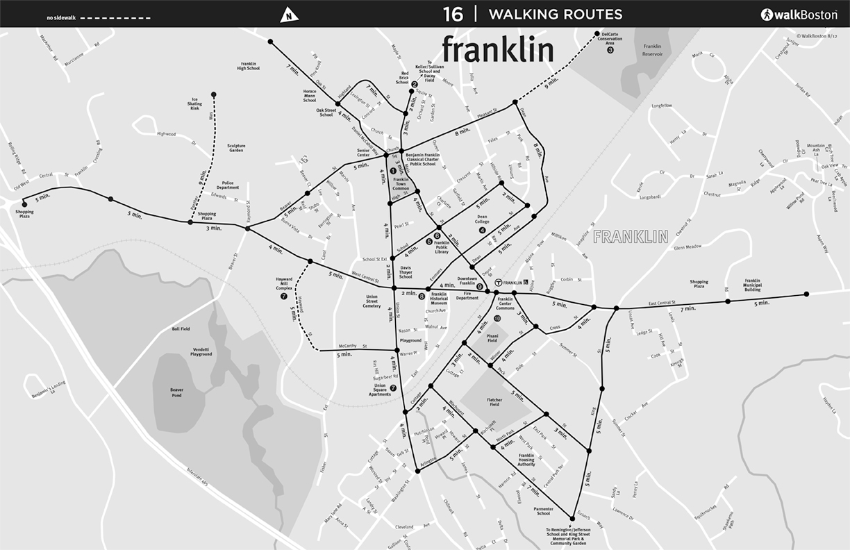
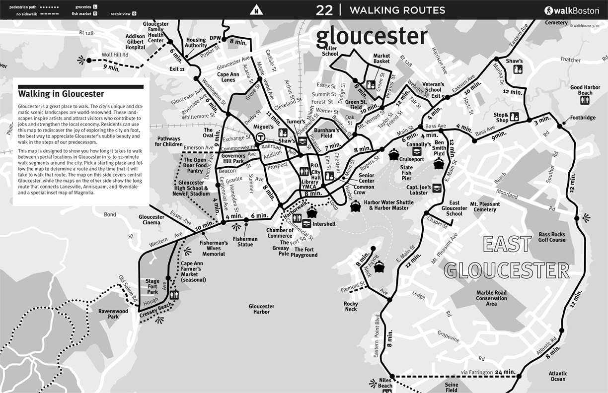
| Financial District | Franklin | Gloucester | Harvard |
 |
 |
 |
 |
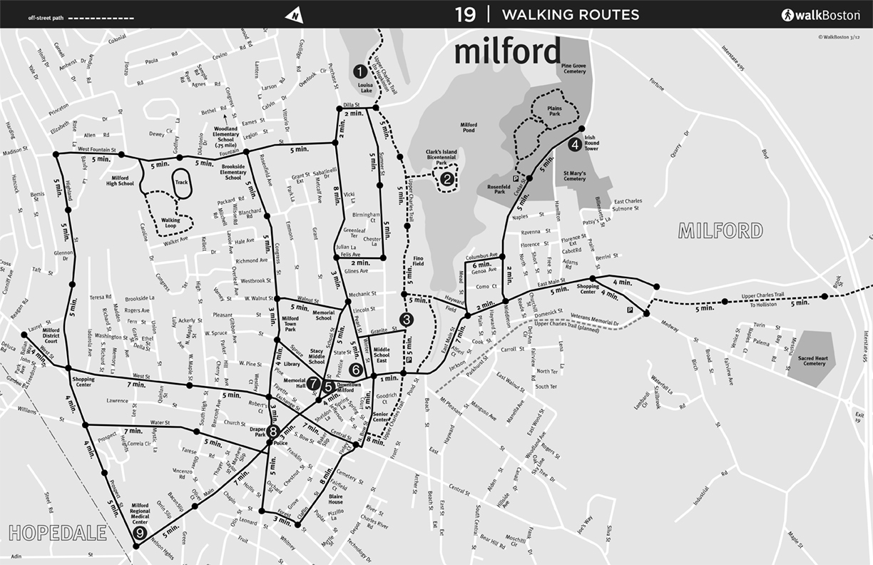 |
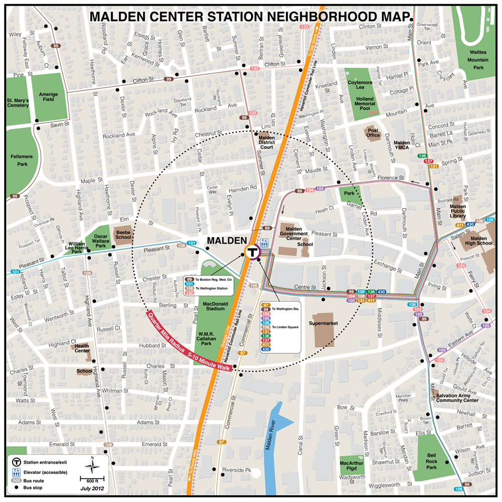
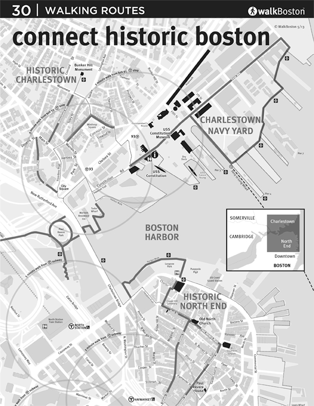
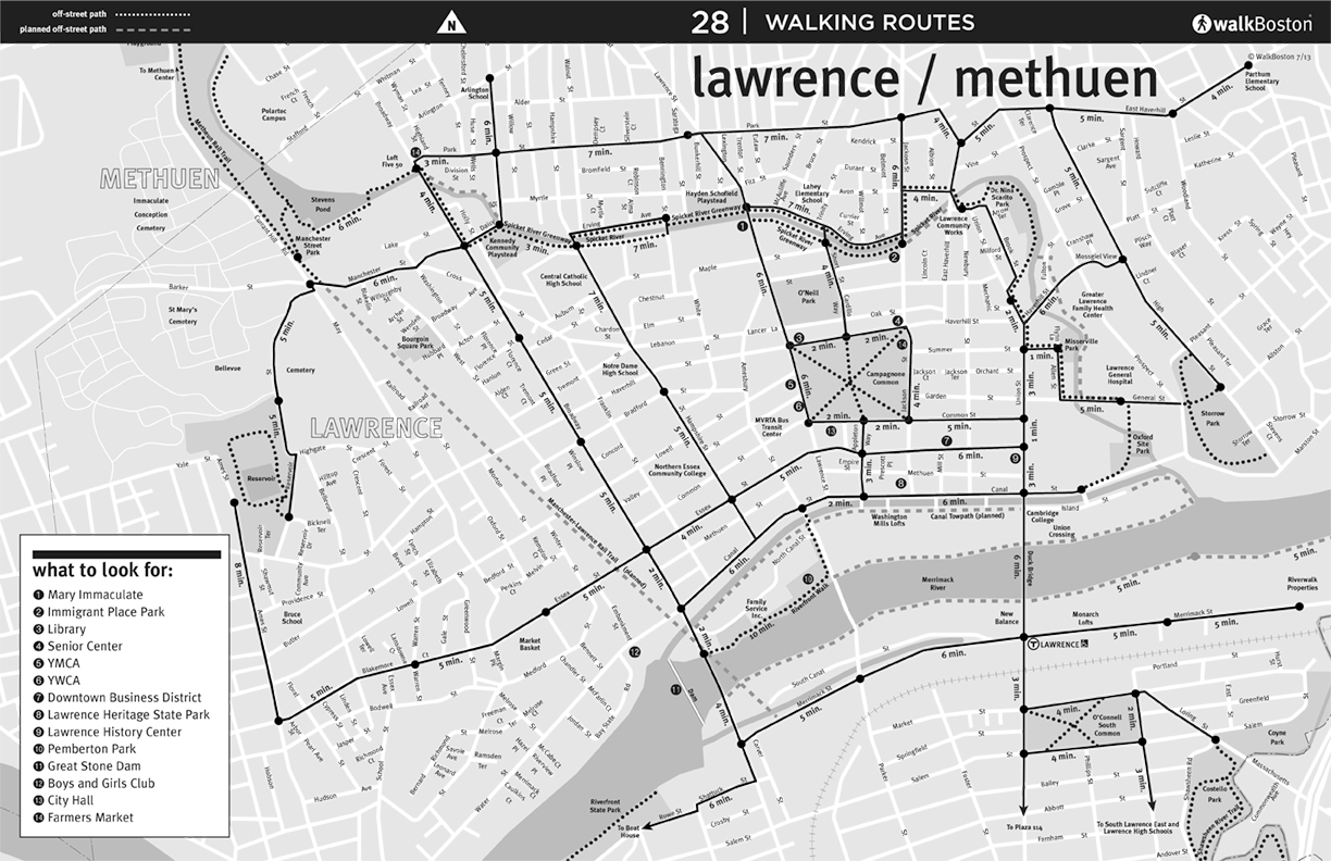
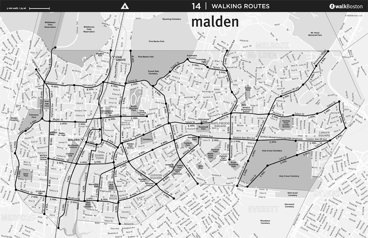
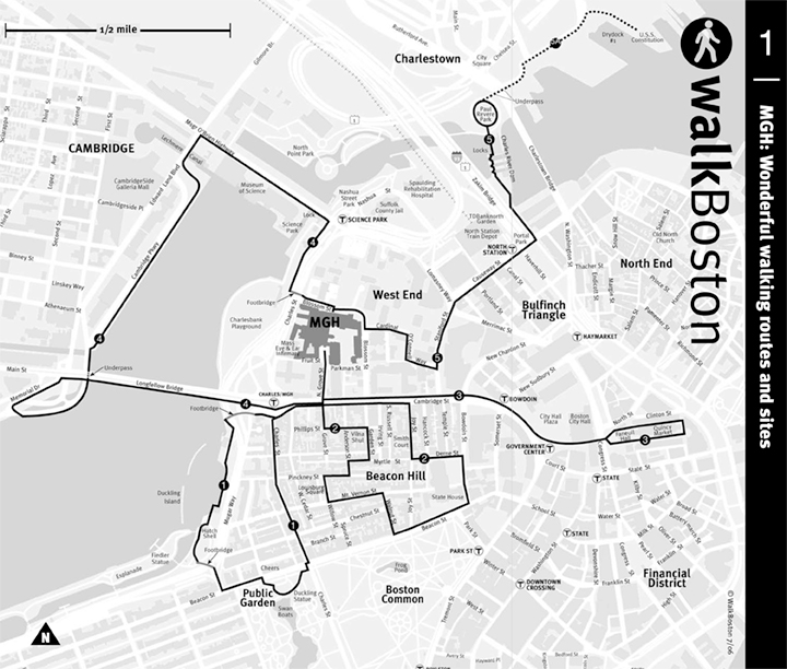
| Lawrence | Malden | Mass. General Hospital | Milford |
 |
 |
 |
 |
 |
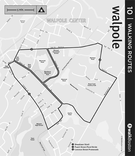 |
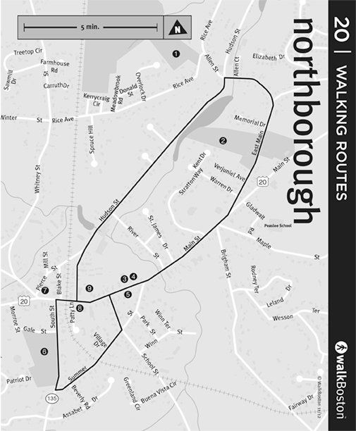
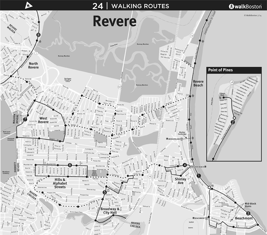
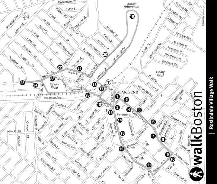
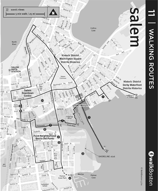
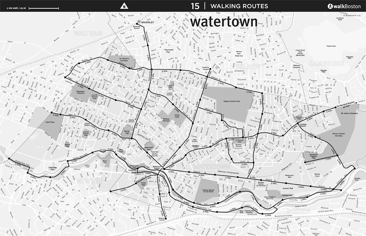
| Revere | Roslindale | Salem | Springfield | Walpole |
 |
 |
 |
 |
 |
 |
 |
 |
 |
 |
 |
 |
 |
 |
 |
 |
 |
 |
 |
 |
 |
 |
 |
 |
 |
 |
 |
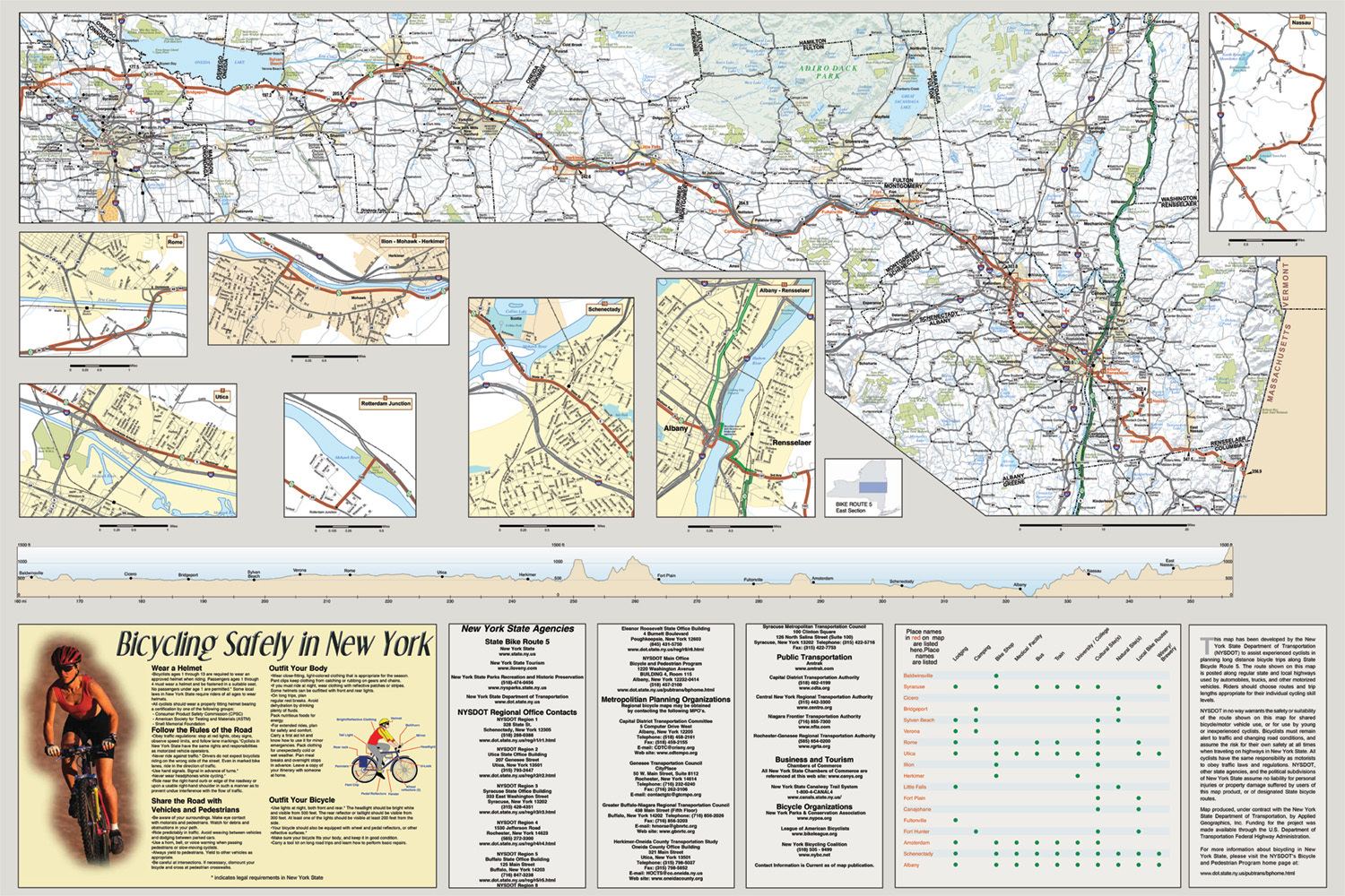 |
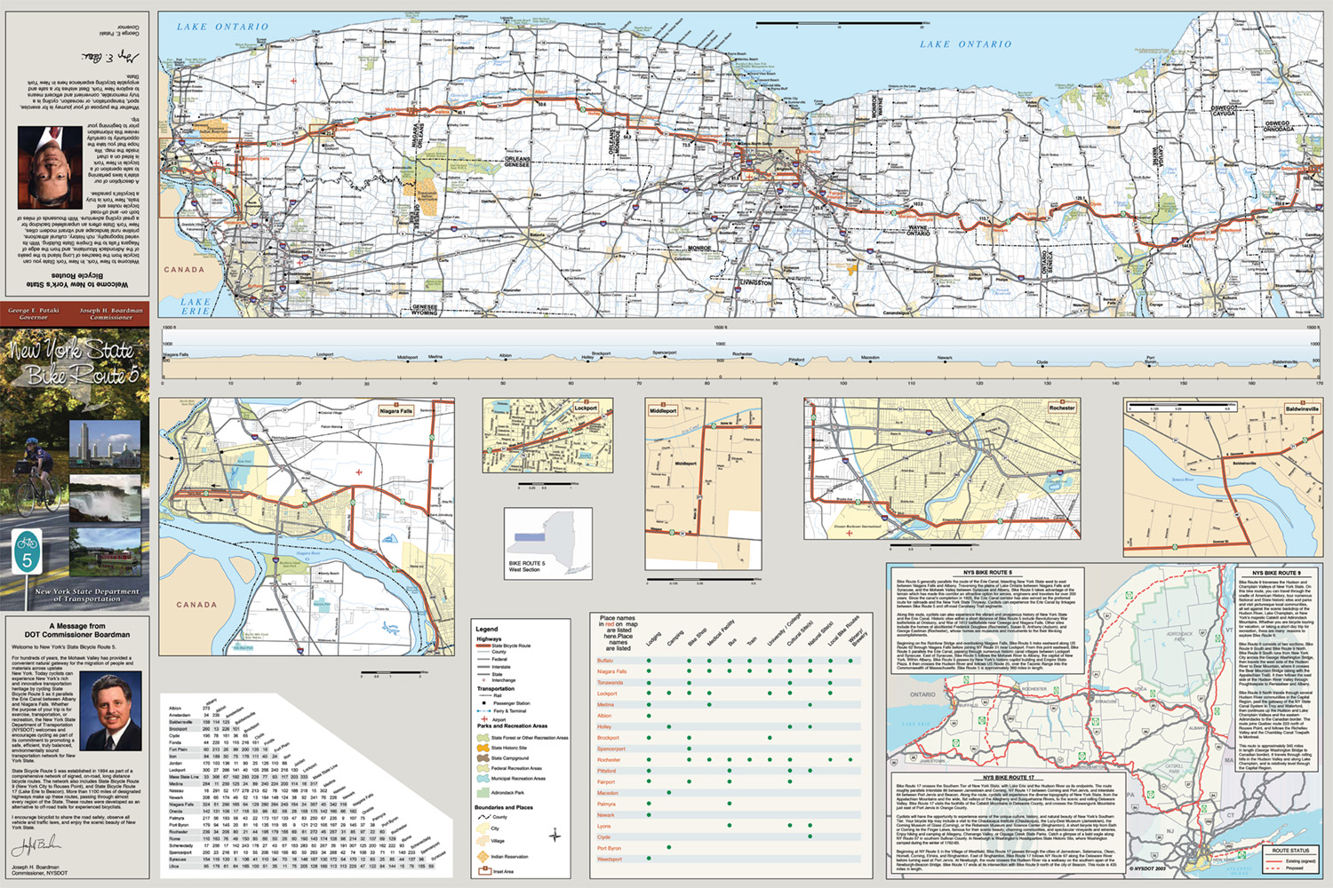
| New York Bike Map Route 5–Back |
 |
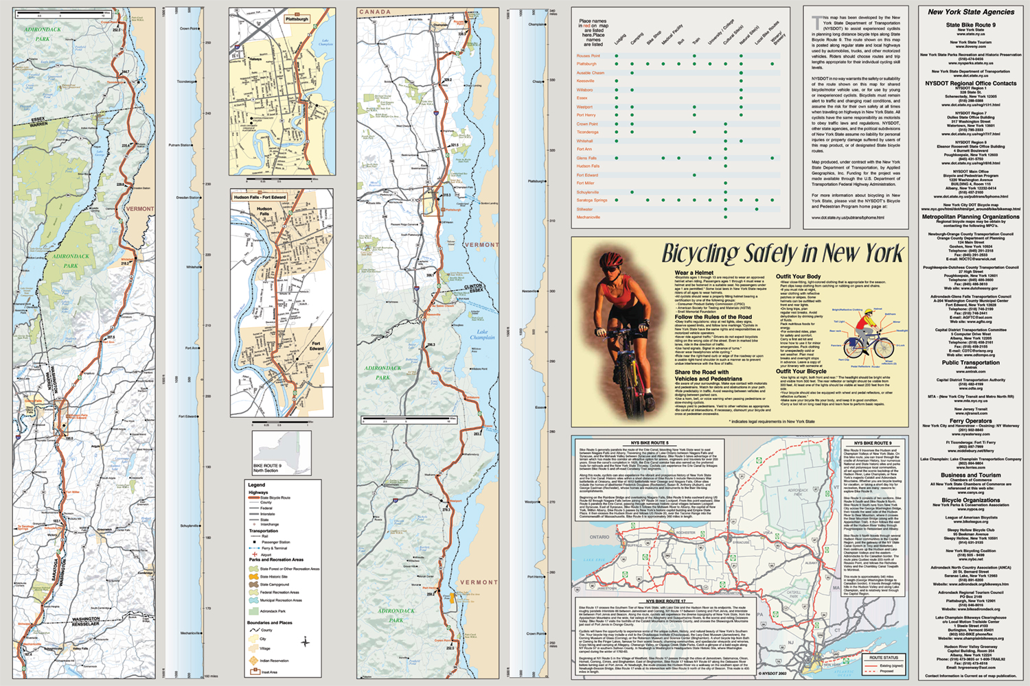 |
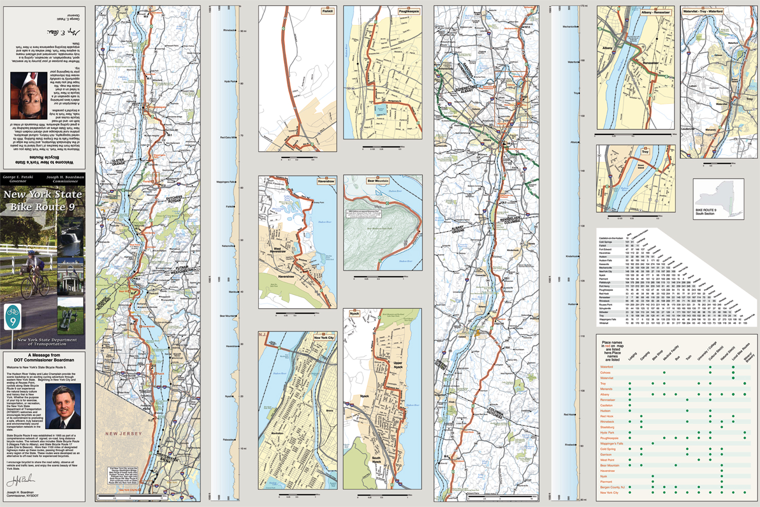
| New York Bike Map Route 9–Back |
For more information contact me at: mapmanbyday@gmail.com